The first batch of six Odyssey boats completed their canal transit today, We are scheduled to transit with four other boats starting tomorrow, probably late afternoon, probably reaching Gatun Lake after dark, and spending the night there. Tuesday should be an early start, and into the Pacific by late afternoon. It’s all a little uncertain because we’re in the middle of Carnival, which is a big holiday here, and we can’t count on people showing up and keeping promises after they’ve been out partying all night…
The boat is probably more ready than it has been for any departure to date. New alternator is working. Oil has been changed (earlier than recommended, but if we don’t do it here, then we’d probably have trouble disposing of the old oil). Replacement for broken fitting on boom is procured and installed. Newly fabricated fittings to improve the strength of the screecher side stays arrived and are in place. Missing bolts in jib roller furler have been replaced. New propeller is installed on hydrogenerator. We’ve topped up our diesel tanks. We’ve filled our water tanks.
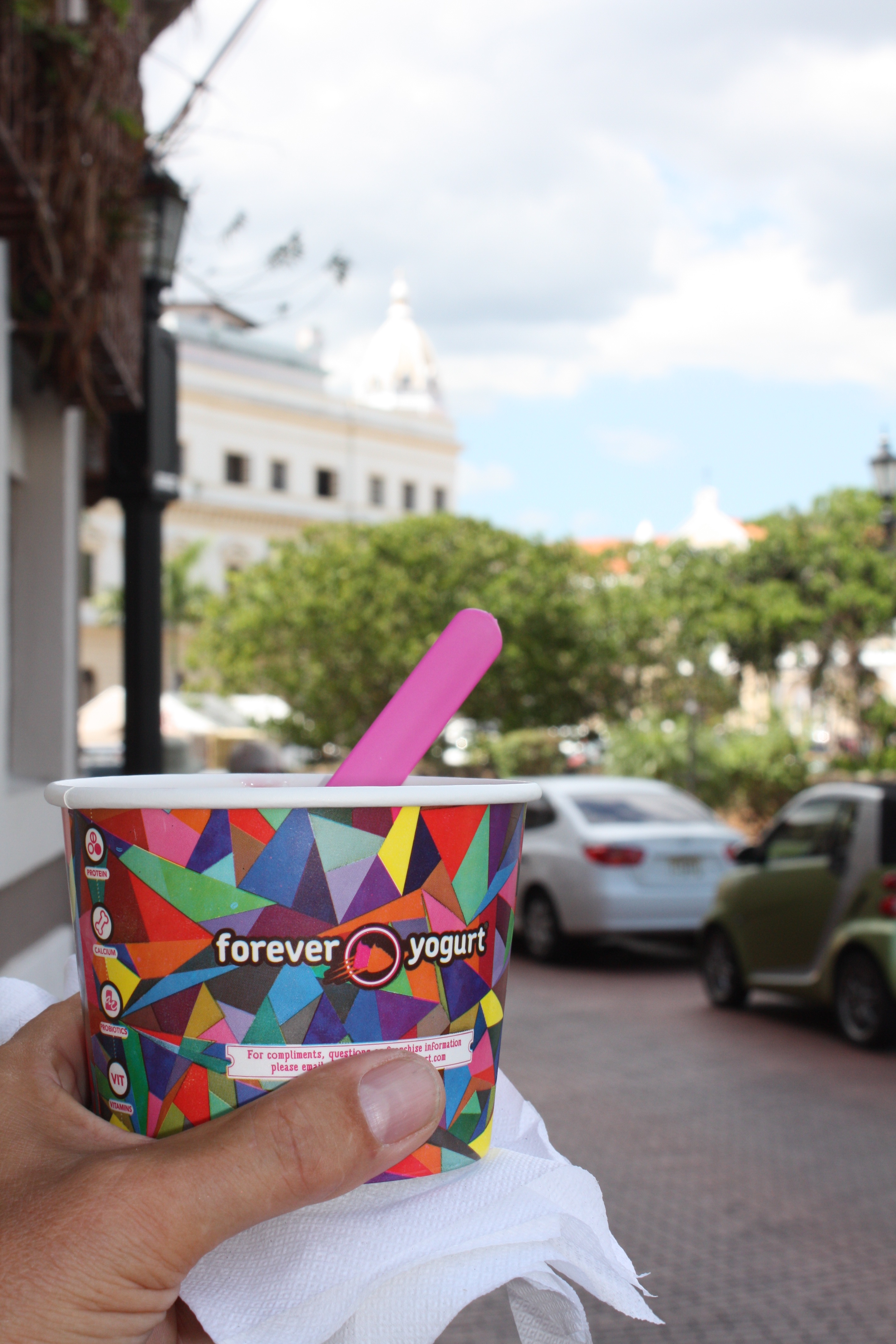
We did our big provisioning run to the supermarket in Colon, an hour’s bus ride away. Because we were spending $500, the supermarket offers a van to bring us back to the boat. I’m uncertain just how long we’re trying to provision for. Can we get food (that we want to eat) in the Galapagos? In the Marquesas? But really it doesn’t much matter. We couldn’t pack any more food on the boat anyway. Our lockers are FULL.
The one thing we still need is some fresh food: bread, fruit, veggies. I’m hoping the “mini-market” at the marina will have enough of these things to make do. We should have some basic fresh fruit and break to feed our canal Advisor/pilot and line handlers. We’ll find out in the morning…
Emotionally we’re all ready to go. We’ve been here long enough (it’s been a week).
The Canal has web cameras (still photos, not video) that update every 30 or 60 seconds. There are high resolution images for the Gatun Locks and Miraflores Lock. We will pass through the former tomorrow evening, but it will probably be too dark to see us. Tuesday afternoon, though, perhaps around 1:30pm (Panama and Eastern USA time, 1830 UTC), we should be at the Miraflores Lock. The photos are from quite a distance, so don’t expect to recognize anything more than the distinctive shape of our boat. We will have our tracker turned on, so if you want you can watch our progress on the BPO web site, and when we get close to the Miraflores Lock (toward the south end of the Canal) you can check the web cam and try to spot us (and watch the water level drop in the lock).
Our understanding is that we will move through the locks in a “nest” with Maggie and Om. Om has the most powerful engines, which will probably put them in the center, with Maggie lashed along one side and us rafted to the other. This arrangement doesn’t make much sense, though, as it leaves the largest and smallest monohulls rafted together. Maybe our Advisors will change the plan — it is all up to them. Everything is subject to change, including our starting time.
This is probably my last “wifi opportunity” for quite some time — at least until we arrive in the Galapagos, and maybe not even then. So no more photos for a while, but I’ll be sending occasional updates via SSB radio and asking Hallie to post them for me. I have enjoyed all the comments y’all have posted. Keep ’em coming, even though I don’t see them until I get to the next wifi spot.
Do you guys have to do daylight savings time on the sea?
Time at sea is an interesting thing. The three of us could declare it to be any time we want, and it wouldn’t much matter, EXCEPT that sometimes we have scheduled radio calls with other boats. Our time has to be in sync with their time or we miss the call. If their boat is far east or west of ours, then it might be in a different “time zone,” and saying we’re going to have a call at 3pm could lead to problems — 3pm their time might not be the same as 3pm our time. (In California, for example, it is 3 hours earlier than in Maine, so 3pm on the West Coast is 6pm in Maine.)
In order to avoid this confusion at sea, sailors refer to UTC time. (UTC stands for the French phrase for Universal Coordinated Time.) This used to be called GMT (Greenwich Mean Time), referring to the time in Greenwich, England, and it may also be called Zulu time. All of these refer to the time at longitude 0 degrees. If another boat agrees to a radio call at 1600 UTC (4pm at 0 degrees longitude), each boat can figure out what time that is locally. In our current time zone (same as Maine), we are 5 hours earlier than UTC, so it would be at 1100 (11am) local time. UTC time does not get adjusted for daylight savings. So once Maine goes on daylight savings time, the difference between Maine and UTC will become 4 hours instead of 5 hours.
To keep things simple, many boats at sea just set the clock to UTC time and stop thinking about what time it is locally, so you don’t have to keep converting back and forth. In that case the crew doesn’t have to “do” daylight savings time, until they interact with people ashore, when you have to get in sync with everyone else.
What do you mean by “gringos?”
In most of Latin America, including in Panama, “gringo” generally refers to any citizen of the United States. In some cases it is applied primarily to white people, but not exclusively so. It sometimes is used in a disparaging way (an American who does not respect the local culture, maybe doesn’t speak Spanish or doesn’t try to, who expects things to be like what they are accustomed to in the USA instead of adapting to the local ways), but often it is simply referring to one’s origin. The three of us aboard No Regrets are gringos.
How long do you think it might be before global warming goes into full effect?
This is a hard one! First of all, the term “global warming” is not used much anymore, because when Maine has a winter with record snowfall and cold temperatures, it doesn’t appear that “warming” is occurring at all. Usually the term “climate change” is used instead, since this is all-encompassing of temperature variations, shifts in rain and snowfall, length of seasons, and other factors that scientists tell us are changing primarily due to increased carbon levels in our atmosphere. Climate change is not intrinsically a bad thing, and in fact we know that there are huge changes to the climate over thousands of years due to factors that are mostly beyond human control (e.g., volcanic eruptions; ice ages). But climate change is very disruptive. It will change the coastline; it will force people near the coast out of their homes; it may cause droughts that will destroy traditional farmlands; it may cause floods; etc. So climate change is generally considered “bad” in the context of things under human control (like how much coal and oil we burn), and “just the way it is” in the context of “geologic time” (many thousands of years).
I am no expert on climate change. But my belief is that the effects caused by humans burning fossil fuels are already happening, and cannot be readily turned back. We know that the average ocean water temperature has been rising. This causes the water to expand a little, and the only way it can expand is “up,” so sea level rises slightly. We also know that Greenland and Antarctic ice has been melting, which also contributes to sea level rise. I think these trends cannot quickly be reversed. So even though they have not yet caused widespread disruptions, I think we will see incremental changes/disruptions over many years to come, even if humans were to reduce the burning of fossil fuels now.
One aspect of the Blue Planet Odyssey is to raise these questions and call attention to them. We need to think about the possible long-term effects of our collective behavior, and push our leaders to make well-informed policy choices.
Is it easy to sleep on the boat?
Sometimes yes, sometimes no. When we are in a marina like we are now, where the water is calm and the boat is well protected, it’s pretty much like sleeping at home. When we’re sailing in substantial waves, it is much harder. It becomes noisy, the boat can toss you around on your berth, and occasinally a wave will slap the side or bottom of the boat with a jarring thud that is almost impossible to sleep through.
But on passage we get into a rhythm of sleeping when we can, and even when it is rough we eventually become so exhausted that we sleep, or do something close to it.
When sailing in smooth waters it can be delightful to lie in your berth and feel the energy of the boat moving, and the gentle surge of the ocean, and this can put one right to sleep. But smooth waters generally means “along shore,” which usually means short day sails, and thus we are not often trying to sleep in these conditions.
If you had all the money in the world, what would you buy for the people on the island, and why?
I’m going to assume by “people on the island” you refer to the local Guna people on the many San Blas islands. Let me know if I’m not answering your intended question.
When Jimmy Cornell planned the Blue Planet Odyssey, he wrote to an administrator of the Guna, and asked if there was some way that we could contribute. Jimmy was thinking of helping to build something — a school or a water cachement system. The response he got was that they didn’t want our help with such things, and if we wanted to help we should contribute money to a scholarship fund to help send some young people to college.
I’m very skeptical about efforts to help other people, other than to help them do what they are committed to doing anyway. So I think a scholarship fund to help students who want to attend college is a good idea, and that is one thing I would do. Other things tend to have unexpected/unintended consequences. It’s tempting to give outboard motors to people paddling canoes, but this might cause big (and potentially troublesome) changes in the culture that I couldn’t foresee.
What kind of transportation did they use on San Blas island?
You may have already figured out the answer to this from my recent posts. Almost all transportation is by boat, and in most cases the boats are dugout canoes (some with little sailing rigs) or larger skiffs with outboards. There are no cars, because the individual islands are too tiny. I don’t recall even seeing any carts or wheelbarrows. There are small airports on a couple of the islands, usually with one small plane per day coming/going to the mainland.
Jimmy arranged for a bus to take most of the Odyssey participants to see the Panama Canal expansion project, to go to Panama City, to see Balboa (where the Canal begins/ends at the Pacific side) and to meet the president of the Panama Canal Authority. Bill volunteered to stay at the boat to meet with people scheduled to assist us; Tim and I went on the bus.
First a little background. The Panama Canal was completed 100 years ago (after decades of work, and horrendous loss of life to disease — I’m told “The Path Between the Seas” is a fascinating book about it, though I haven’t read it). The Canal is 48 miles long. It runs approximately north/south; the north end is the Atlantic/Caribbean side, south is the Pacific. The path makes use of a large lake that was created via dams as part of the canal project. There are locks at each end of the Canal, to raise vessels up about eighty-five feet to the level of the Gatun Lake. The lake also supplies the water to operate the locks.
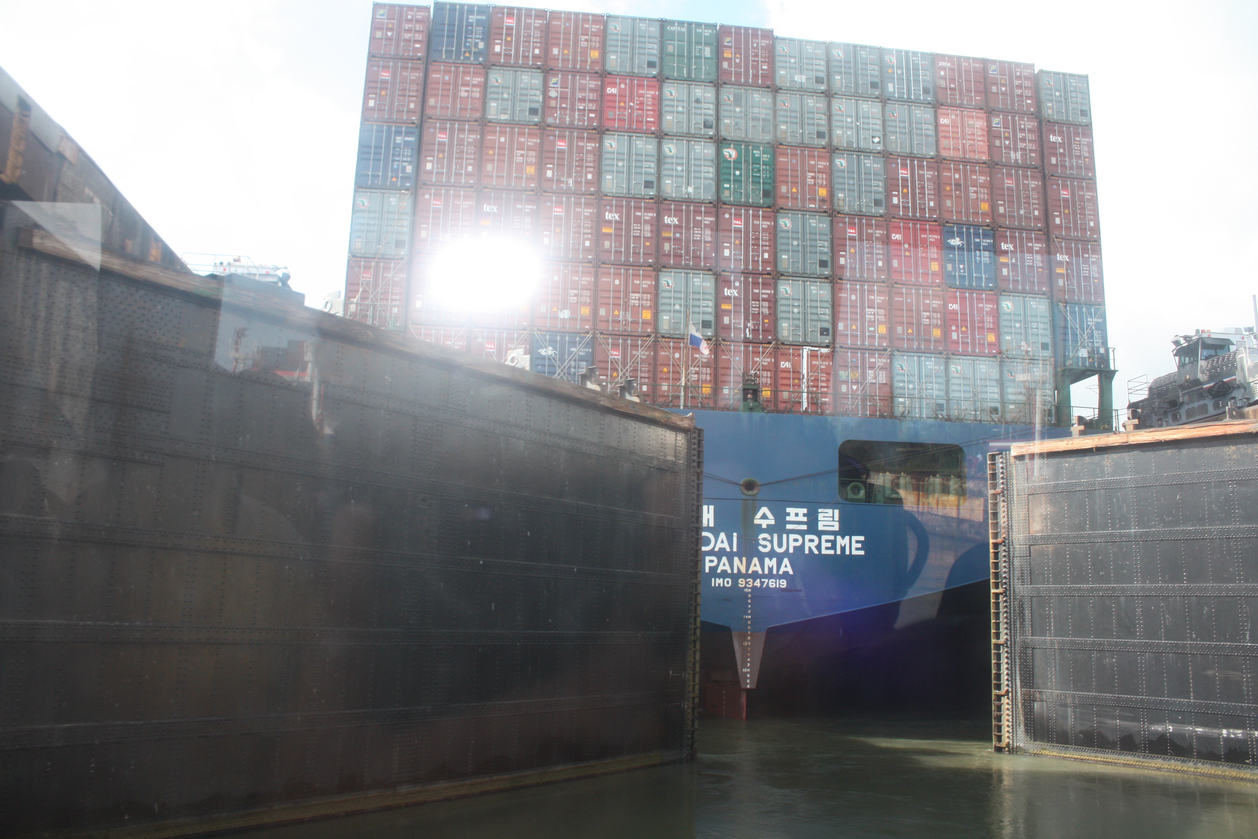
The dimensions of the locks (and to a lesser extent the clearance of the bridge at the Pacific end) determine maximum size of a ship that can transit. The design of some ships is based on these dimensions, and such ships are called “Panamax.” While a Panamax ship is big (close to 1000 feet long, 106 feet wide, with a draft of 41 feet), much larger ships exist that cannot transit the Canal.
A project is underway to build new, larger locks alongside the existing ones, to accommodate larger ships. (And to facilitate maintenance of the old locks, since it will become possible to close them down when needed, without closing the Canal entirely.) It was hoped that the project could be completed in 2014 for the 100th anniversary of the original Canal opening, but naturally there have been some delays. It is now expected that construction will complete this year, and it will open for commercial use next year. End of background.
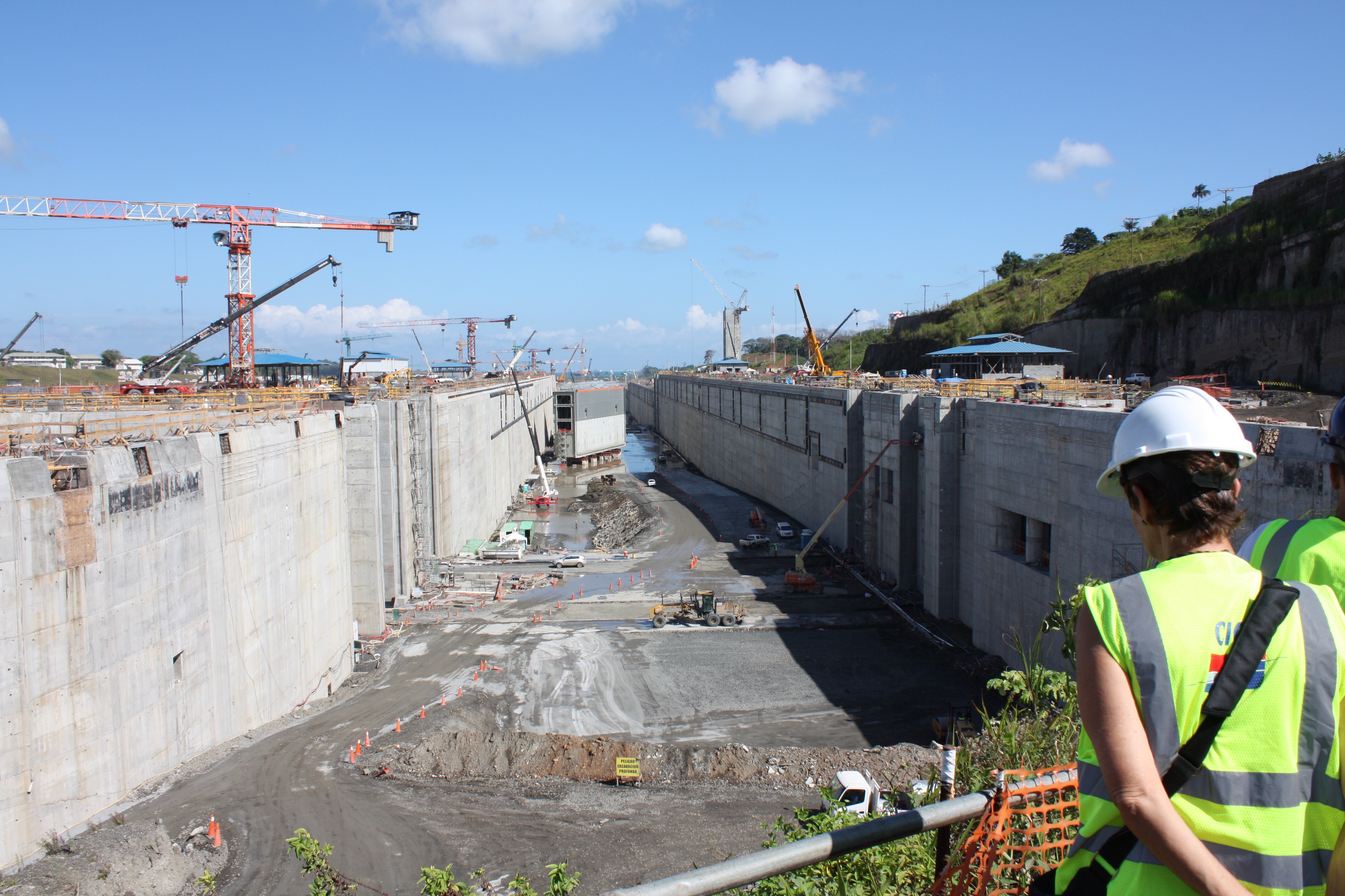
Jimmy had arranged for us to visit the construction site of the new Atlantic-side locks. Shortly before the trip, he was informed that we would not be allowed to enter the site. But Jimmy has connections, and he called a person in a high place who once said, “If you ever need anything in Panama, call me…” Apparently he meant it, because within minutes our trip was back on track.
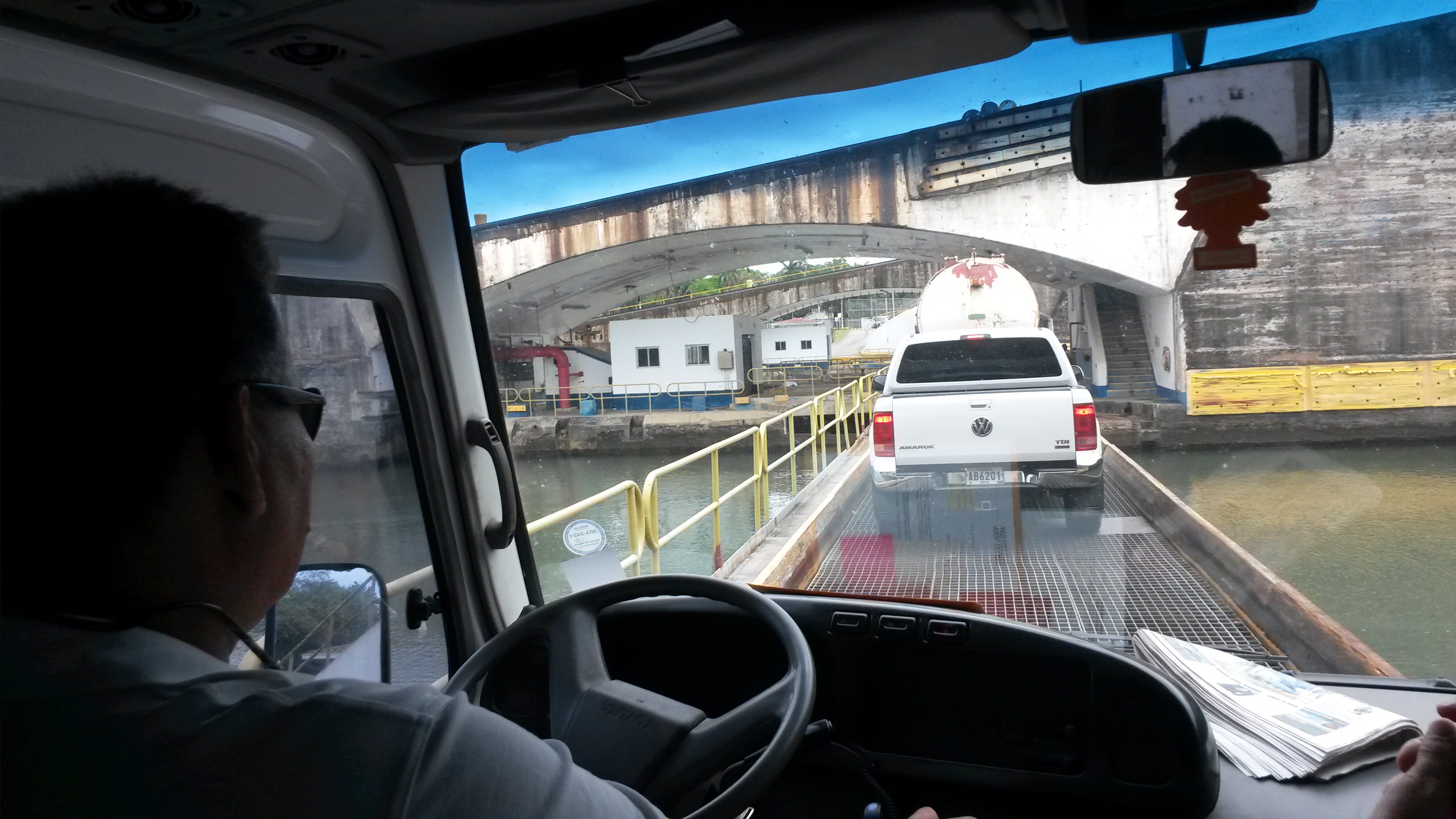
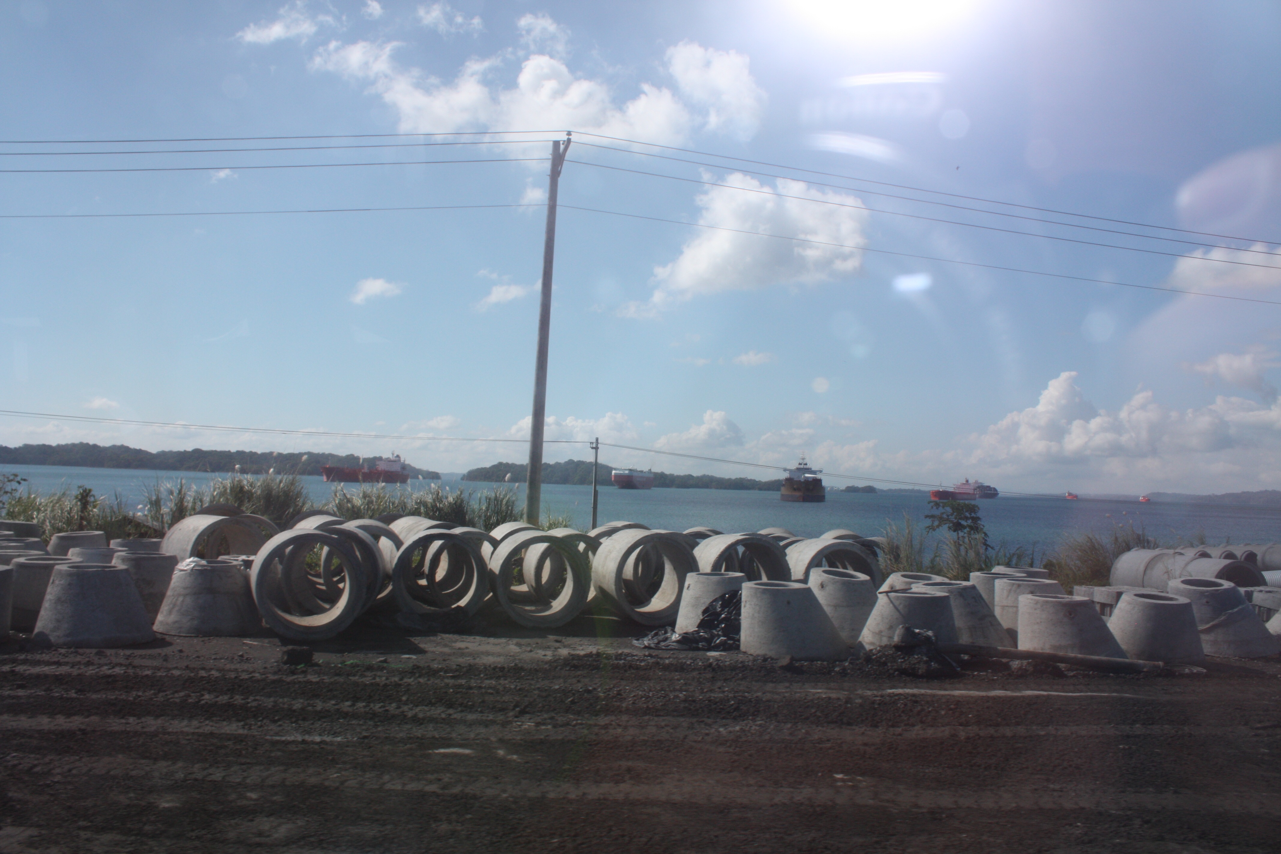
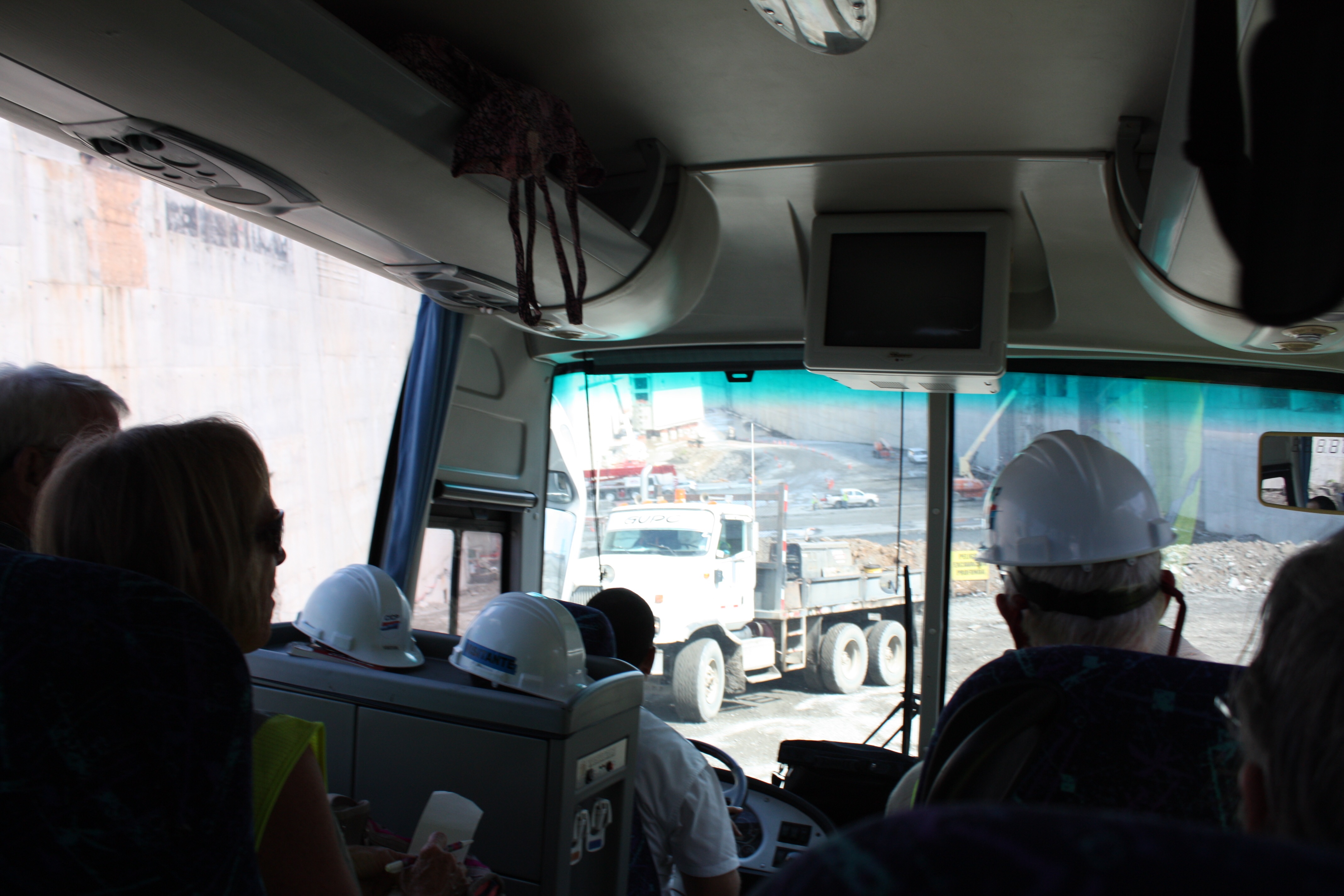
Our bus route required that we drive across the existing canal. At the Atlantic end there is no permanent bridge (yet), so driving across is accomplished via a one-lane movable bridge that is swung into place when a ship is not passing.
As it happened, just as we were crossing the lock doors were closing on a Panamax ship, so this photo from the bus gives you a sense of how it “just fits” into the old lock.
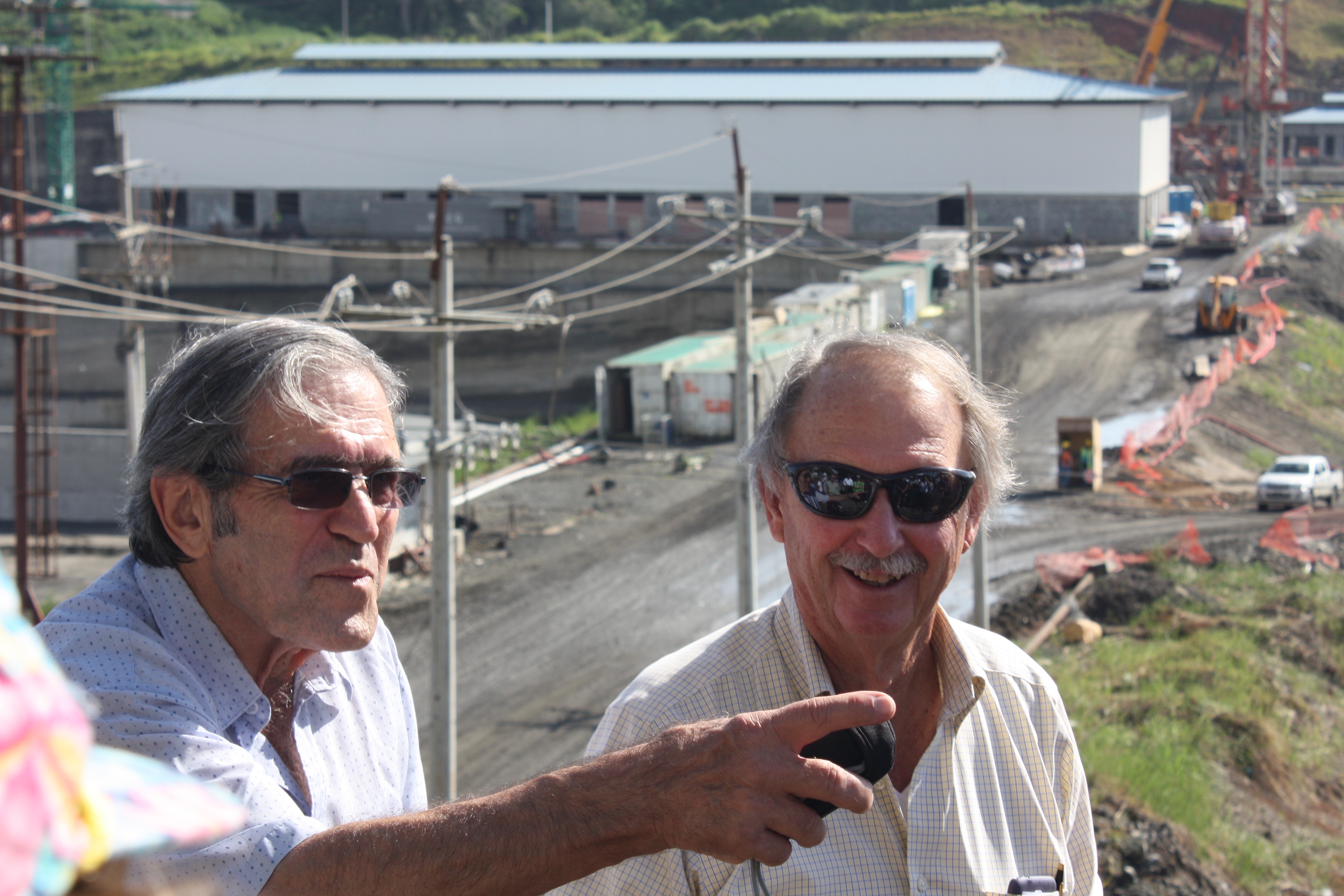
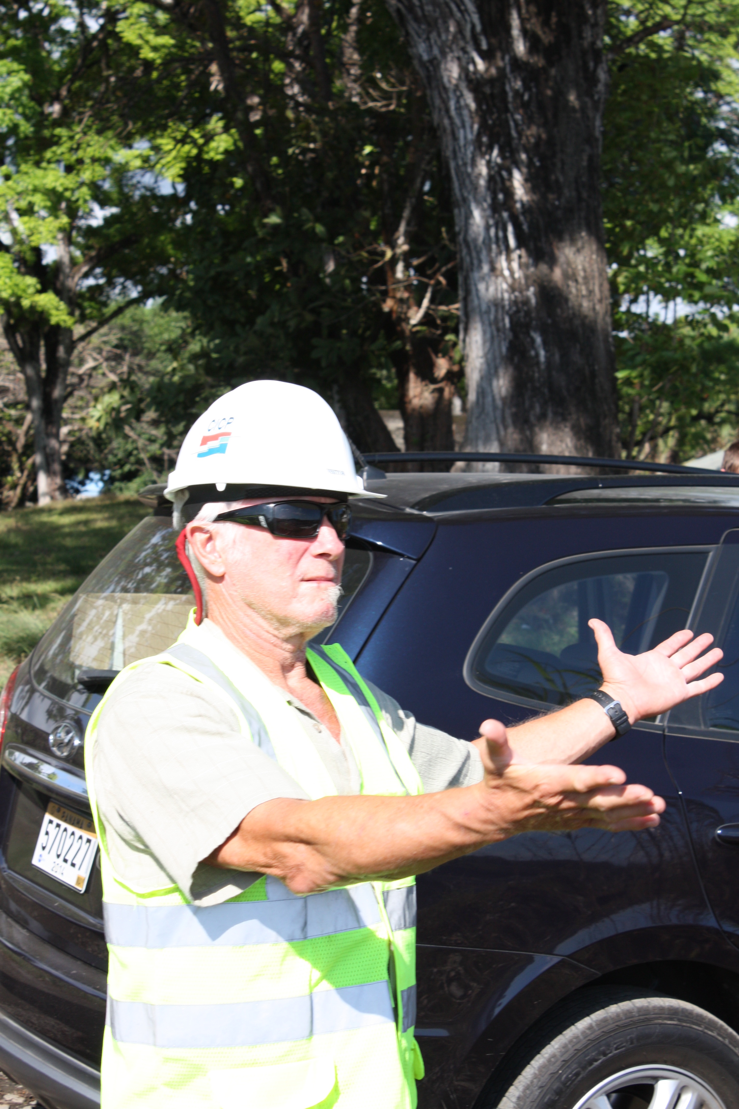
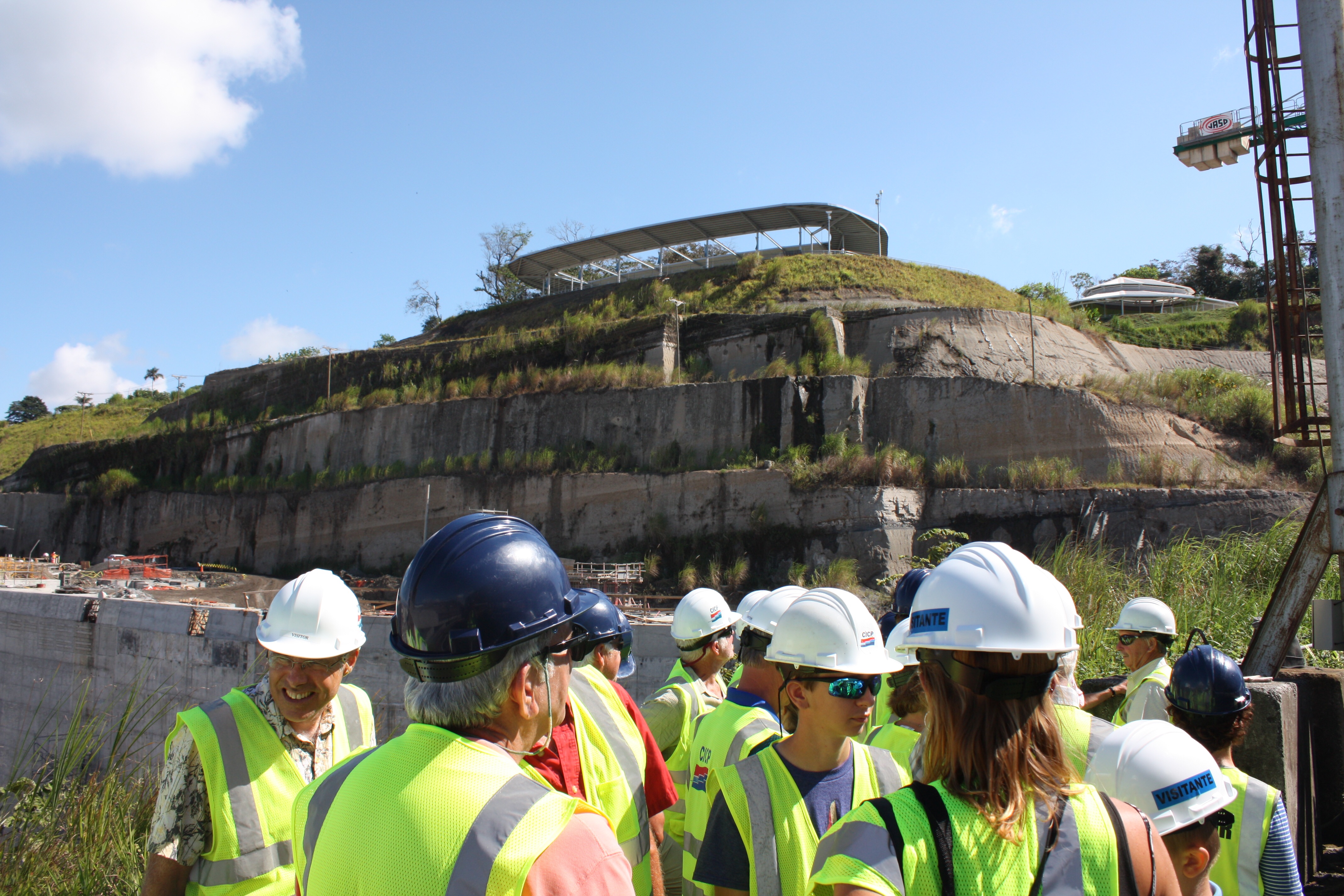
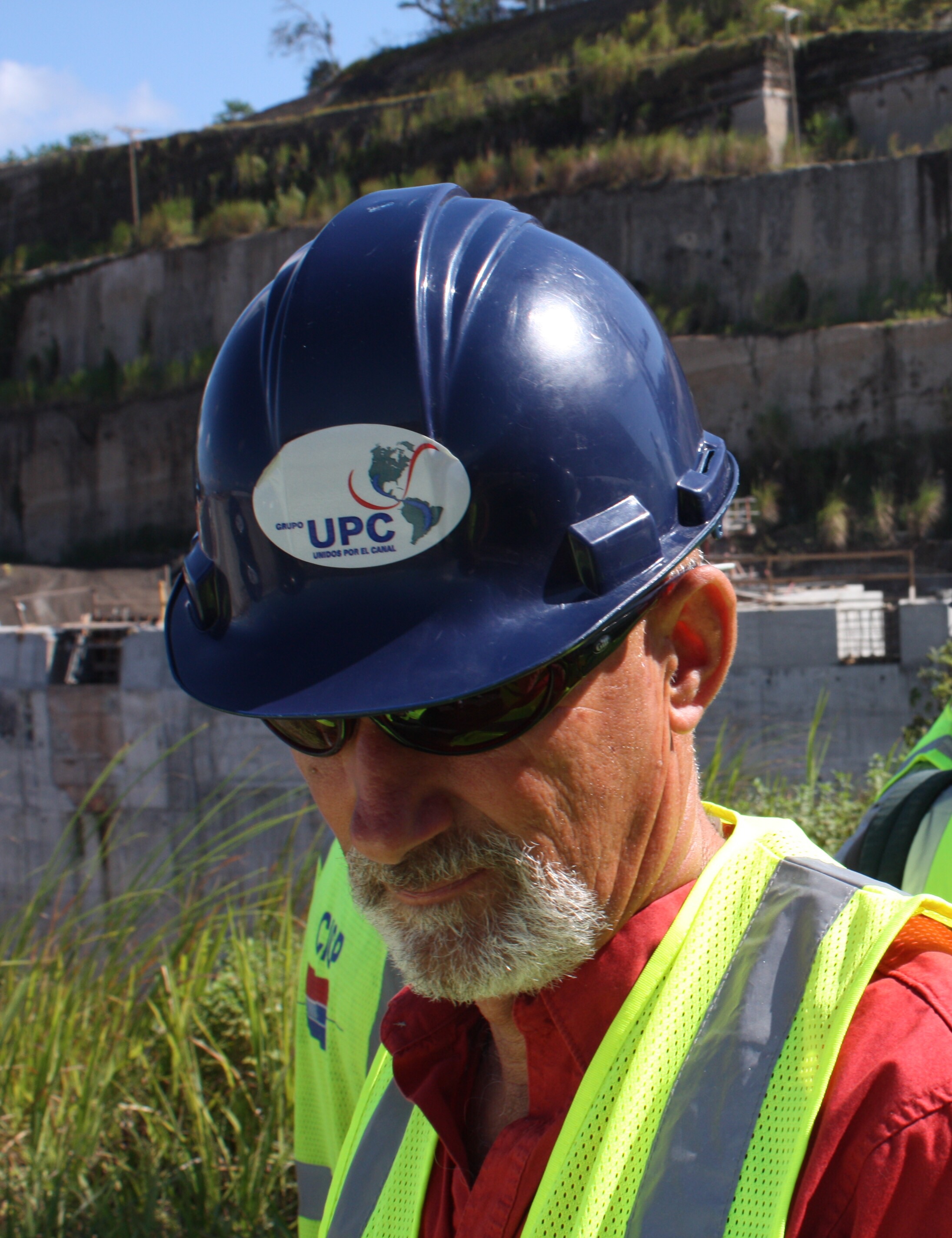
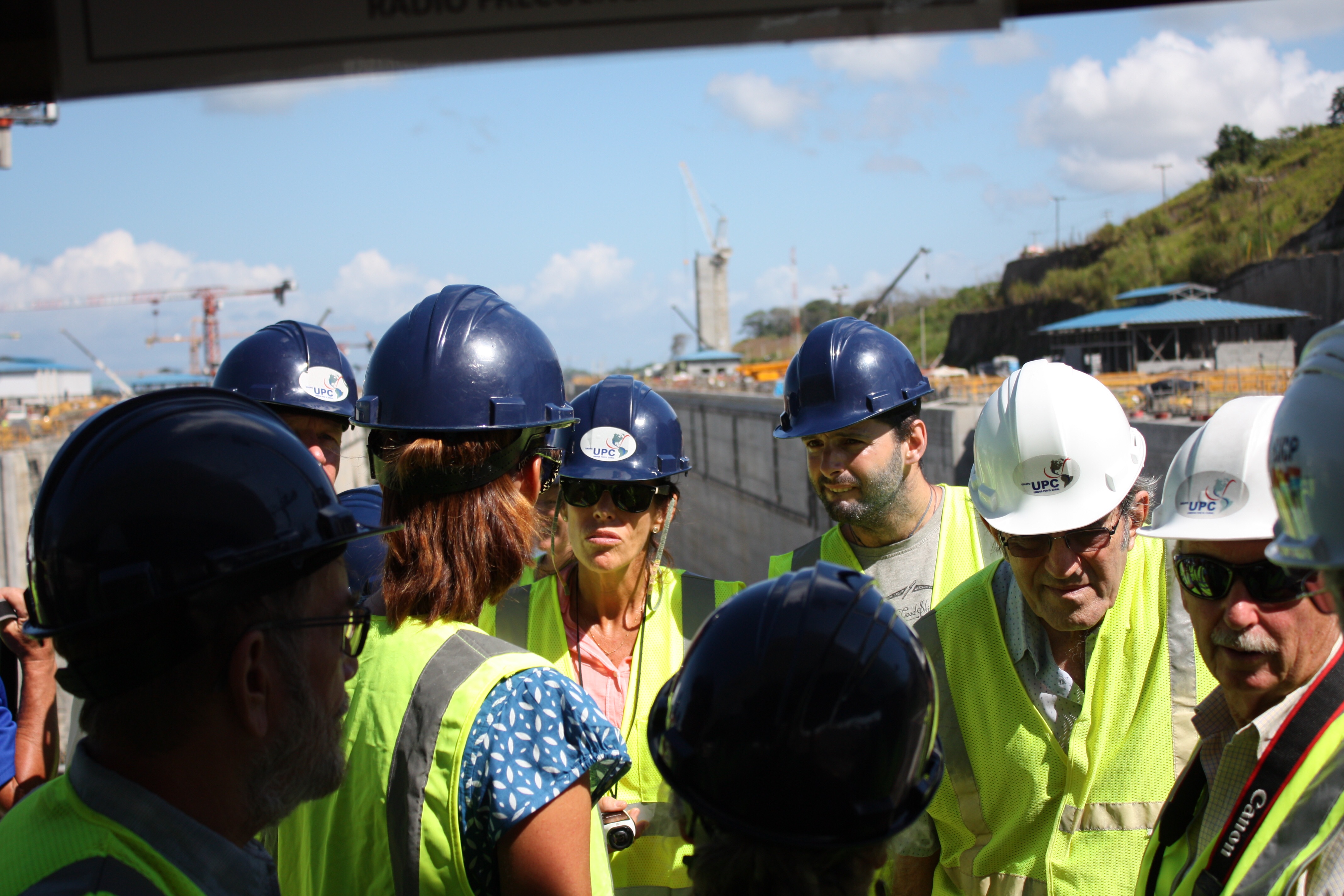
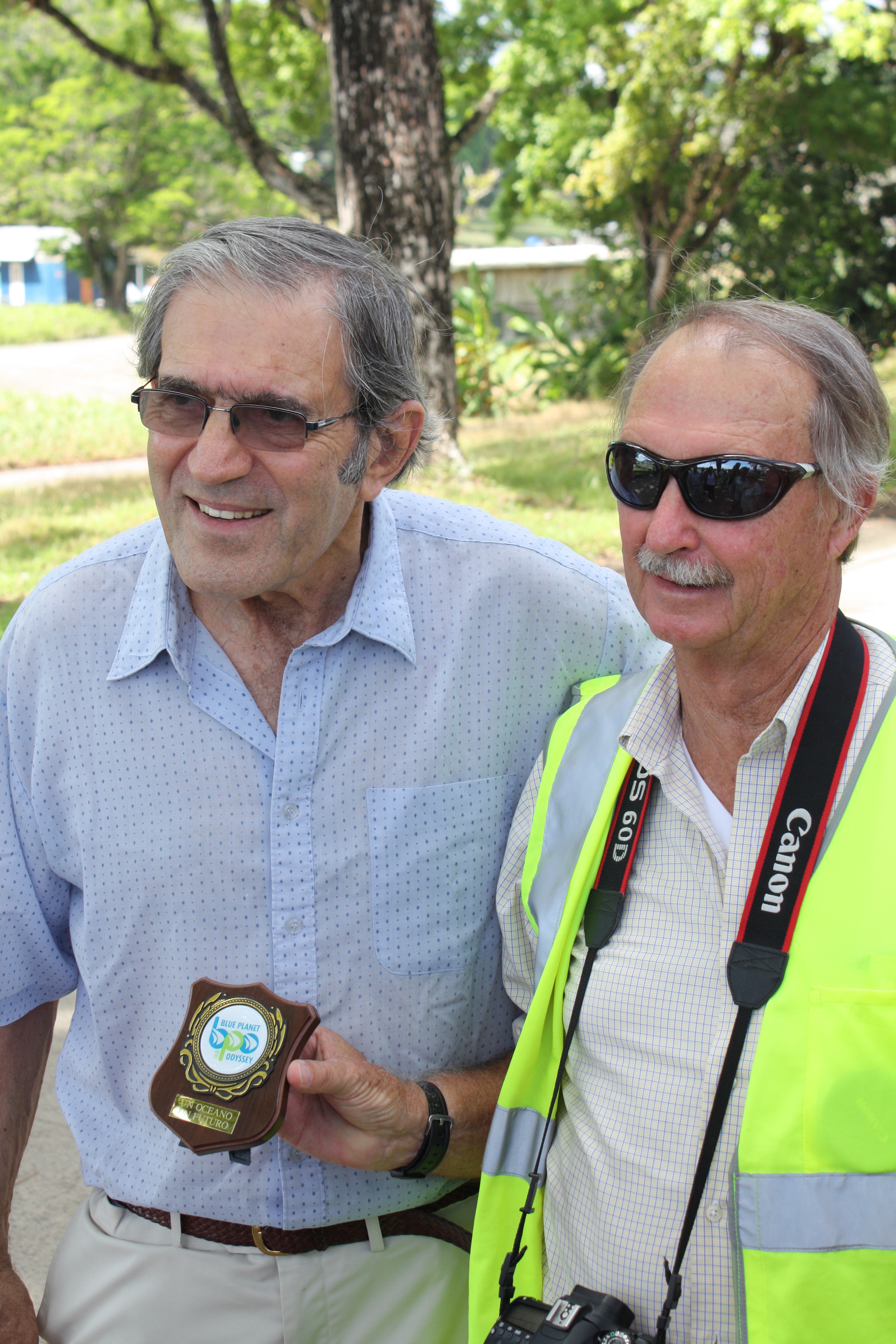
On to the construction site of the new north-side locks. Jimmy introduces Dave Wilson, who is his friend, an American ex-pat, a sailor who fell in love with Panama while living on his boat, and a project manager for the construction effort. We keep Dave busy for the next hour or two with endless questions. But first we all must don hard hats and high visibility vests.
Jimmy Cornell and Dave Wilson
From this vantage point we see a set of three huge retaining pools that will be used to hold the water released from a lock as a ship descends, so the water can be re-used to fill another lock. This design (which has been used for hundreds of years, but not at this scale!) will allow the new/large locks to operate with about the same amount of water loss (from the lake) as the old locks, yet the new ones will accommodate three times more tonnage of cargo in the transiting ship(s).
This leads to some environmental impact thoughts. Of course the water concern is more about retaining the expected depth of the lake, to accommodate the large ships, than it is about the environment, yet the project design seems to include a serious focus on the environment. For example, for every tree cut to make way for the new channel, two were planted. And a contractor was hired for the sole purpose of moving individual animals, from spiders to crocodiles, away from the construction area.
[Dave tells the story of what the process is for relocating a crocodile, which might be up to 20′ long. First a lasso is gotten around the head or tail. Then a second lasso around the other end. Then several more lines around legs, or whatever. A loop is tied around the jaws, and 4 or 5 men jump on the animal’s back — it cannot run with this added weight. Then the legs are “hog tied,” and the animal can be moved to the new location. At that point the process is reversed, more or less, except that the men remain on the back to prevent its running…until all lines are removed. Then on the count of three, the men RUN!]
[As an aside, here’s a question that I found mentally challenging, regarding water usage in the locks. Does it require more water to move a few small yachts through the Canal than it does to transit a Panamax ship…? As Tom and Ray used to say, write your answer on a twenty dollar bill and mail it to us!]
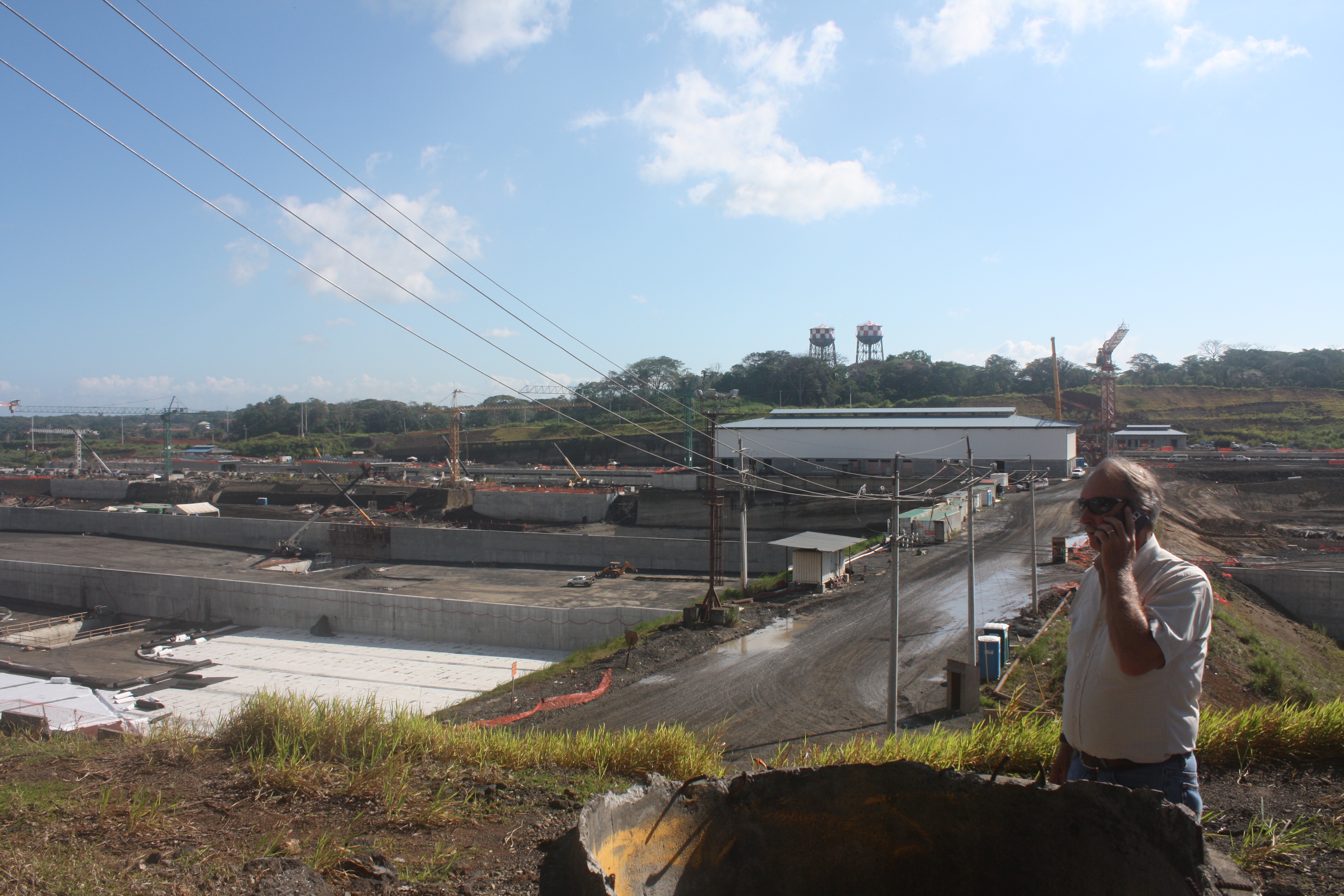
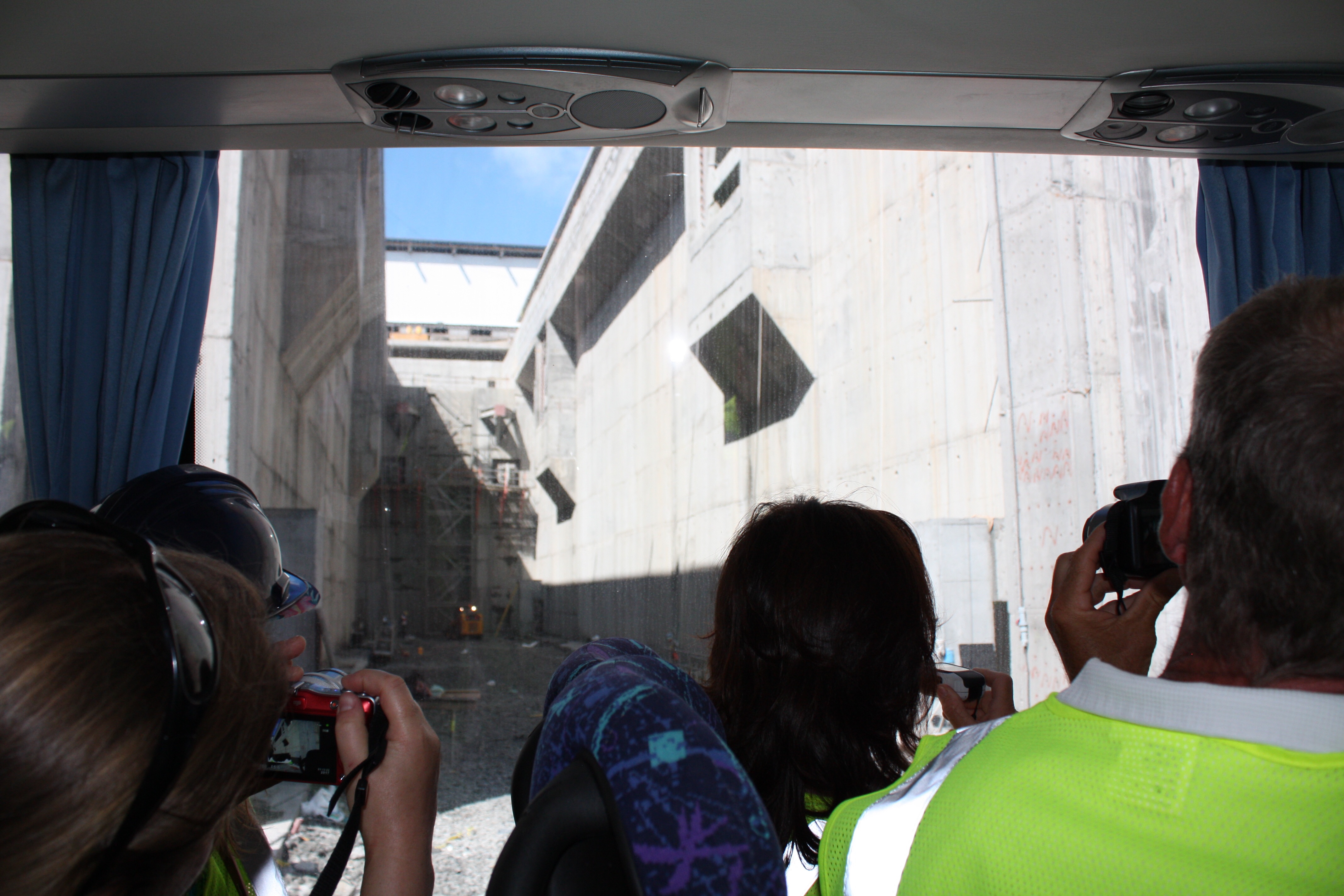
We drive in the bus down to the lake-end of the new locks. We’re on a narrow strip of land with Gatun Lake on one side…
Gatun Lake, with a few ships in transit.
On the other side we are looking down into the length of the new locks. Dave explains that where we are standing is the “Gatun plug,” and it has been the source of perhaps the most sleepless nights of the project. It is this strip of land that will be excavated last, and until then it is preventing Gatun Lake from draining into the new locks (potentially killing workers, destroying some of the work, and draining the lake such that it would require several years of rainfall for it to fill back in after a new plug were constructed). The “plug” has been reinforced with concrete shafts, and is constantly monitored for any sign of leaks. As anyone knows who has built dams on the beach, if a leak gets started the dam will wash away, with little hope of stopping it.
Looking back at the Gatun plug.
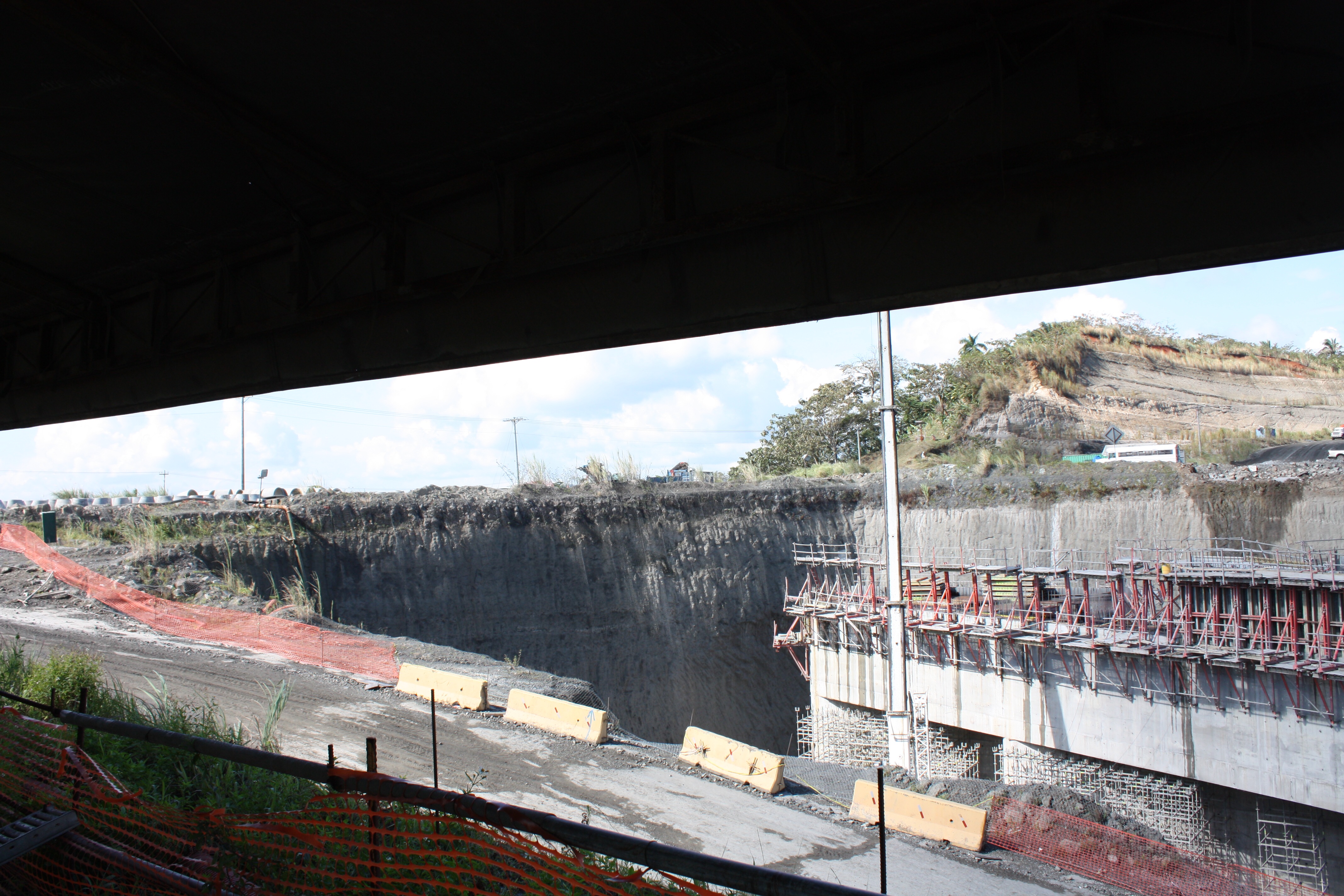
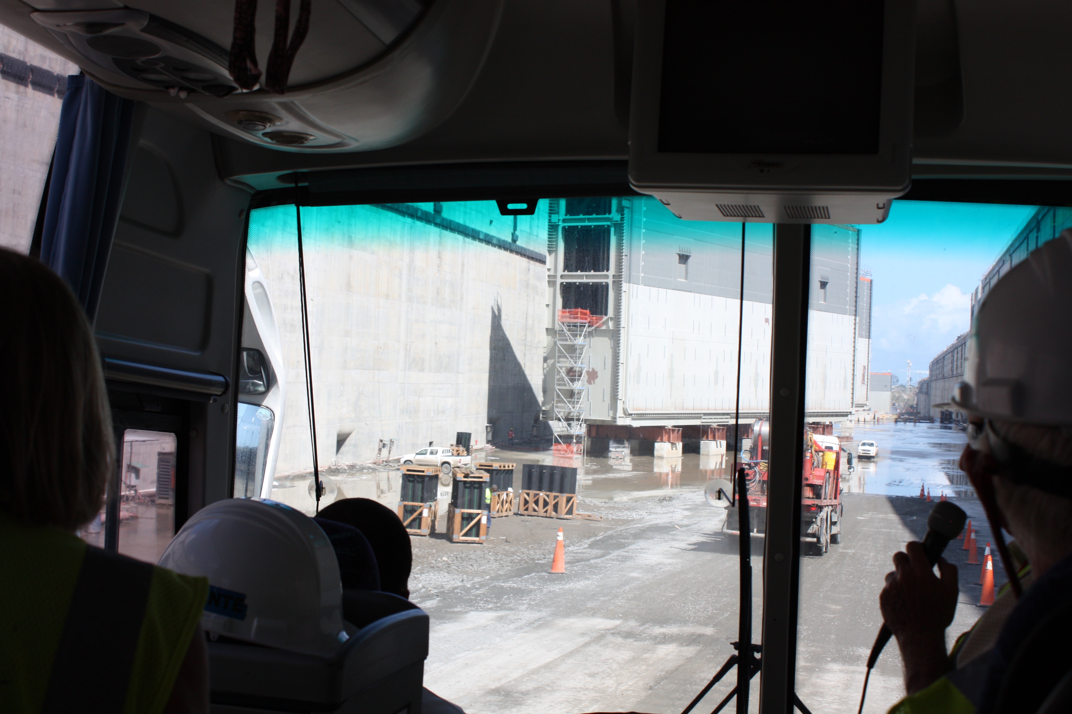
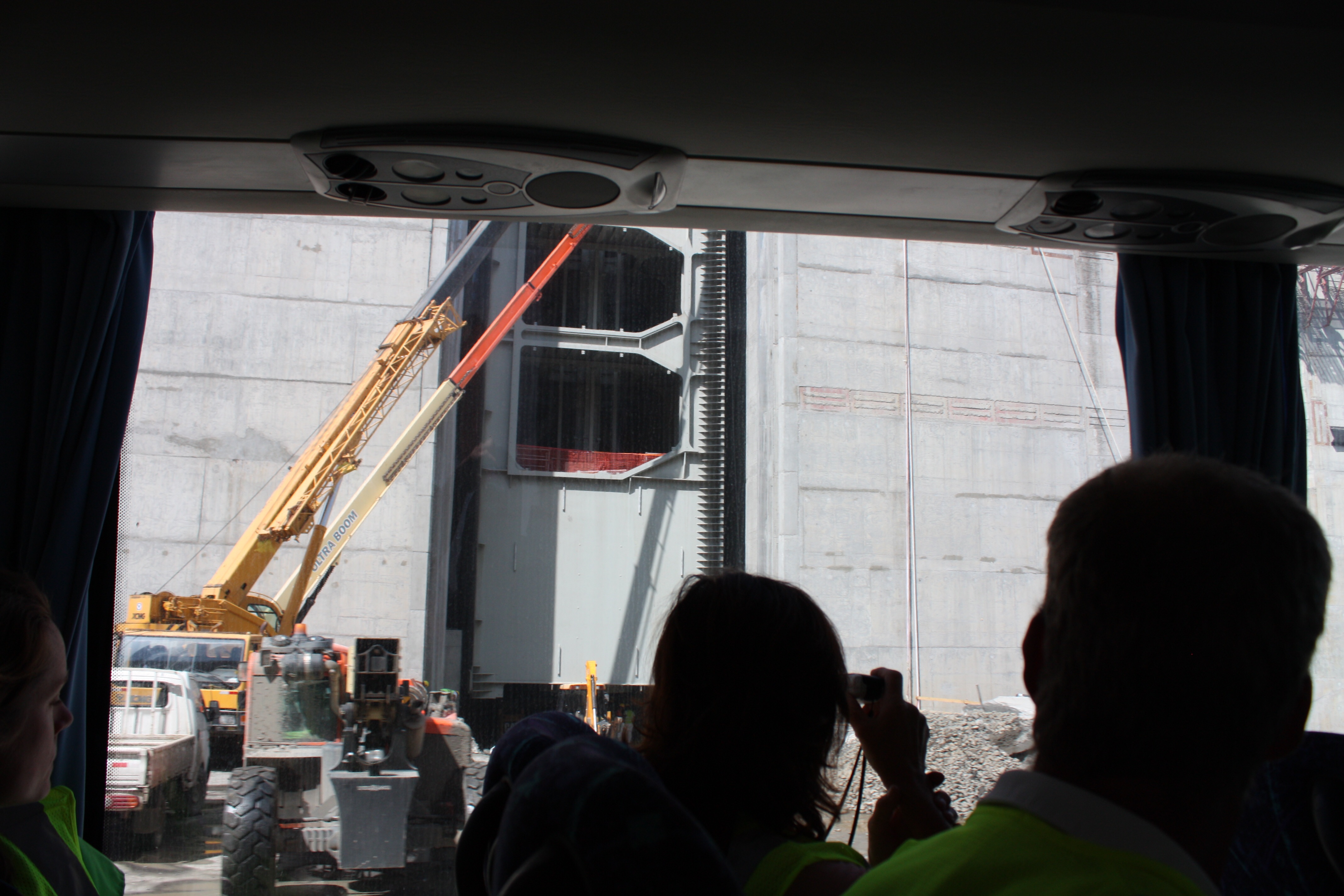
One of the notable features of the locks is the “gates.” Instead of having swinging/opposing pairs of gates, like the old locks, the new locks have massive gates that slide across the channel (and which can be moved into different recesses for maintenance purposes). The gates were built in Italy. They weigh up to 4000 tons each! One hundred feet tall, 180 feet wide, 10+ feet thick. Four gates were secured upright on the deck of a ship to transport them from Italy, and a special dock was constructed in Colon to unload them. Here is one of the gates on its way to being inserted into its slot in the side of the lock. The truck on its way down to the bottom gives some sense of the scale, but the car further on down the bottom of the lock makes the size even more clear.
3500+ TON gate on its way to its new home.The visitor center, kind of like the sky lounge at the airport.Odyssey participant Norm used to do this stuff for a living, didn’t he?
Back on the bus, Dave tells us that “if they don’t stop us” we’re going to now drive down into the locks! We will be one of the first to “transit” the new canal. They don’t stop us.
The lock gate/door.The side slot that will hold the door when in the open position.One of the doors already in its slot.
Jimmy presents Dave with a BPO plaque, and we give Dave a big round of applause. What an amazing and unique experience!
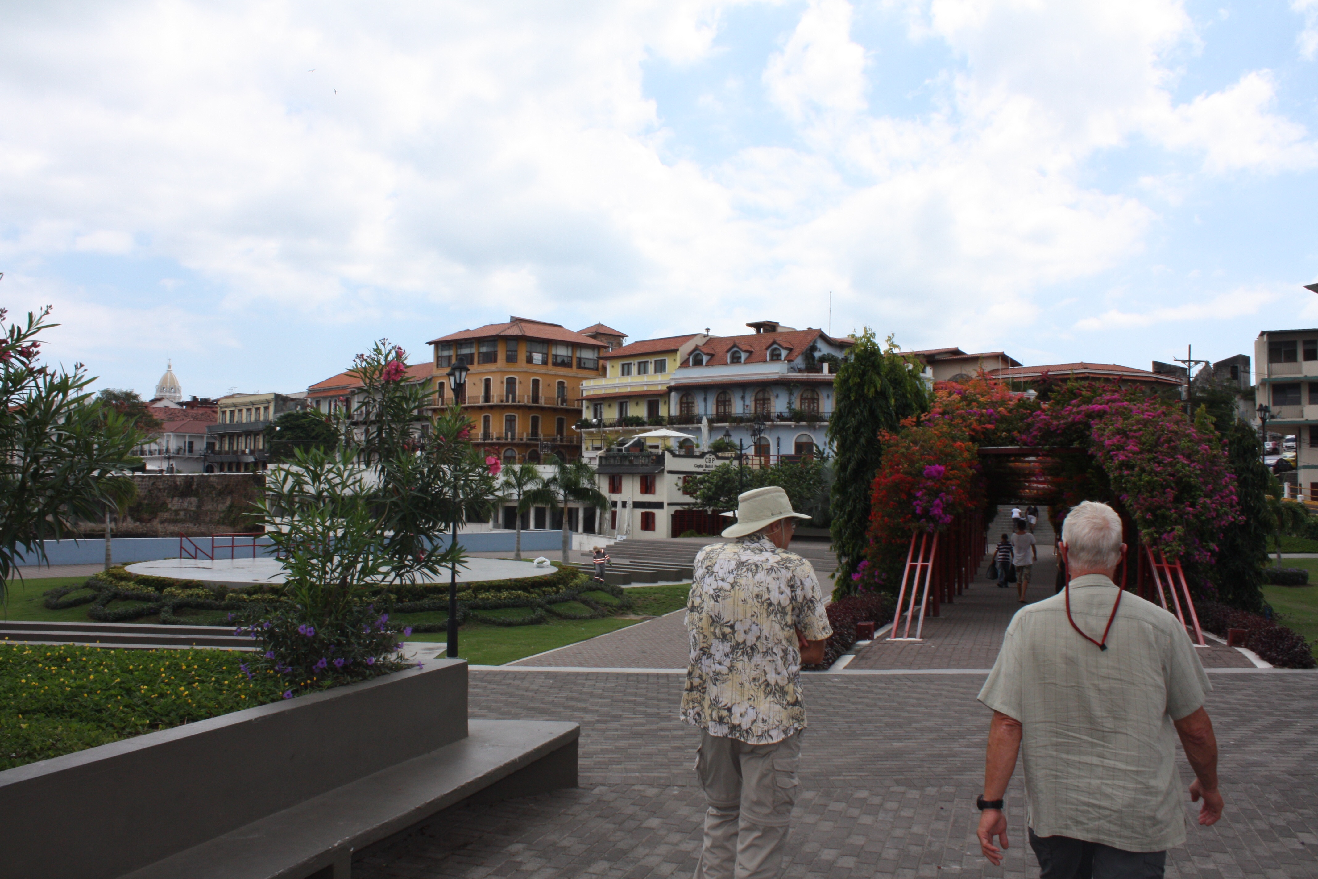
Back on the bus, and across the isthmus to Panama City. (We make a quick stop at a bank with ATMs so a dozen people can get much-needed cash. Panama uses the American dollar for currency, which makes things a little easier, but always more cash is needed than planned…) Then on to the old part of the city, where we take an hour to explore on foot.
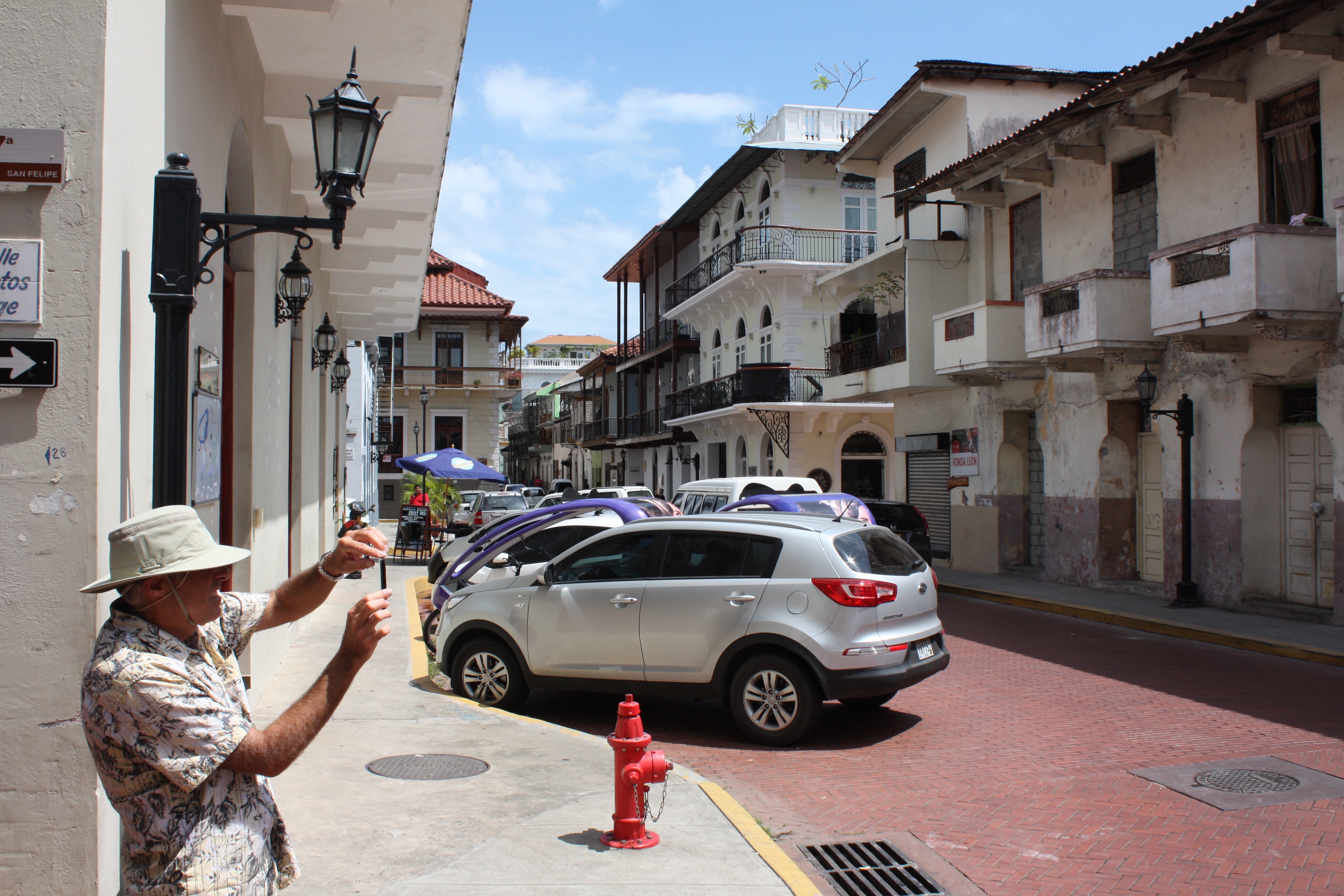
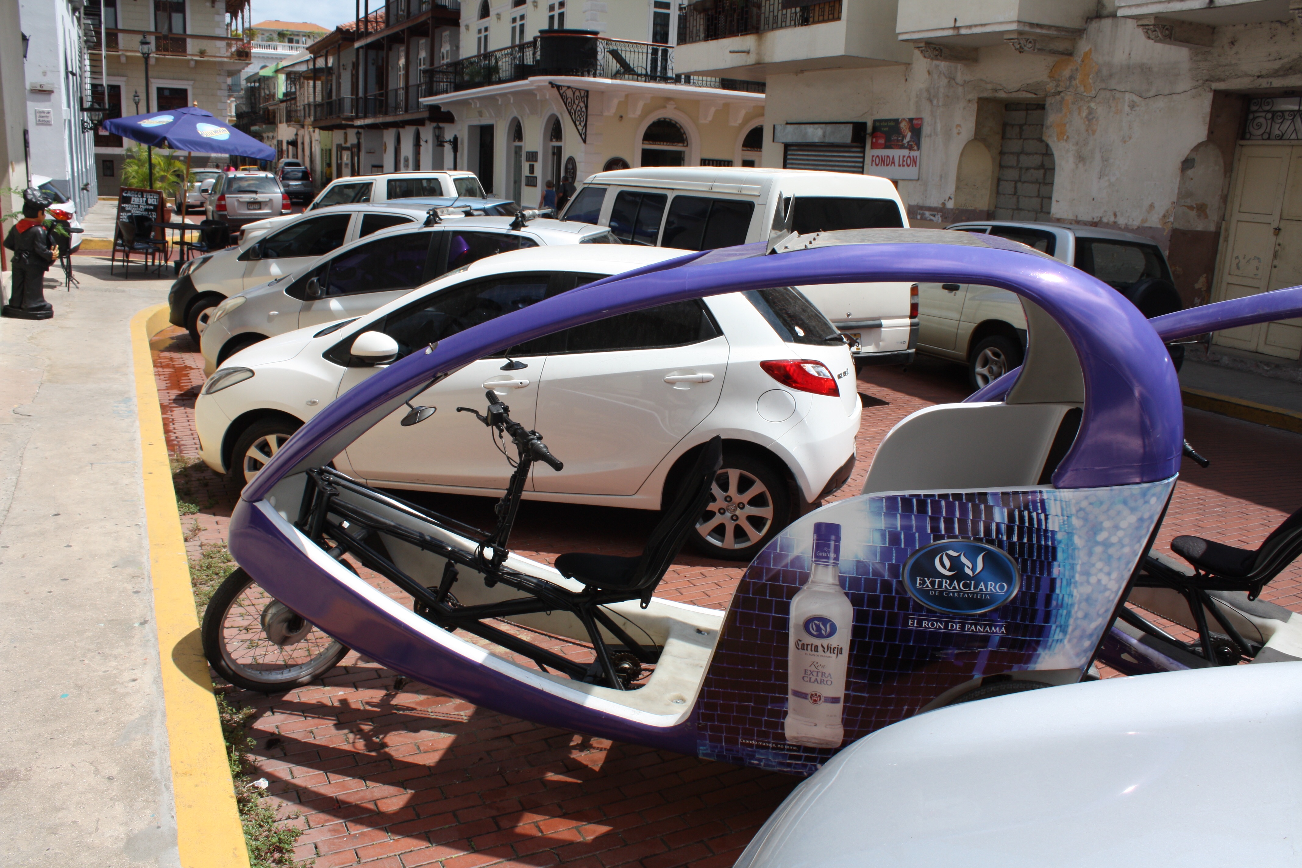
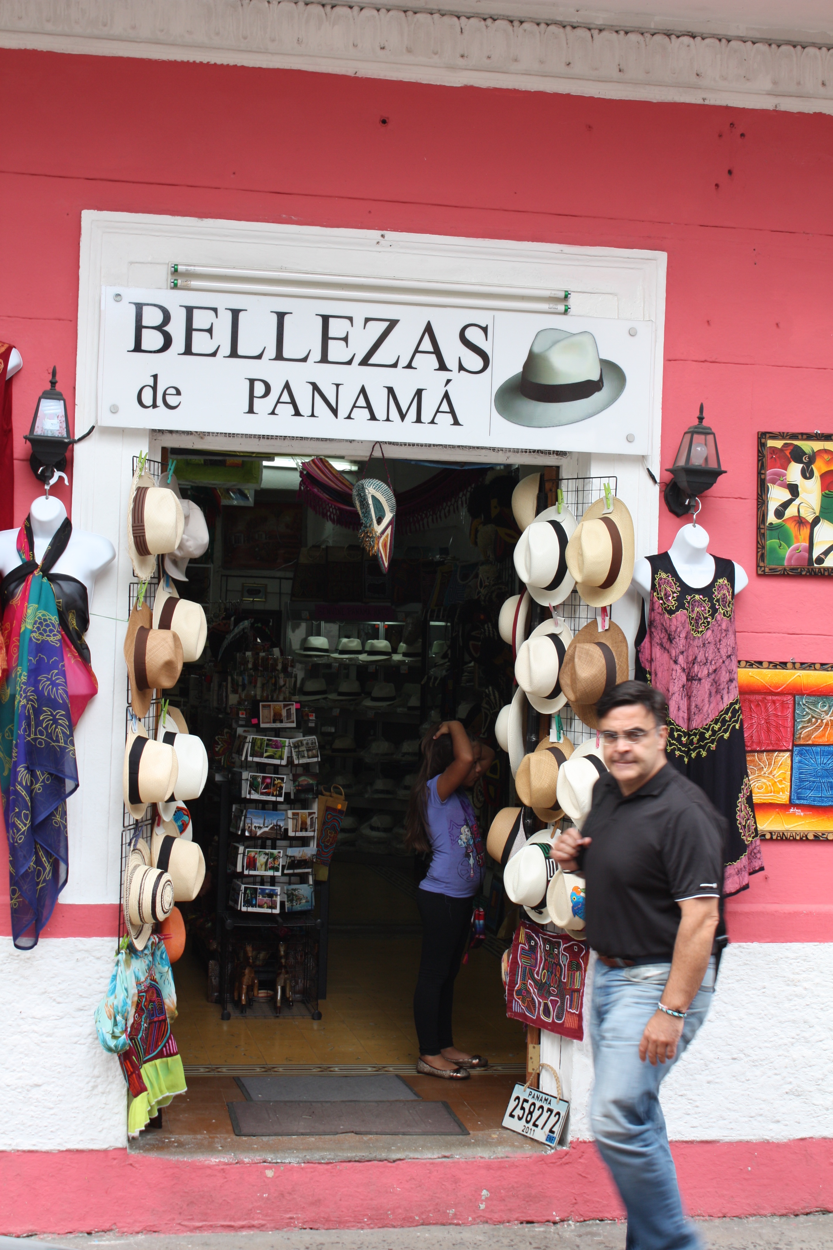
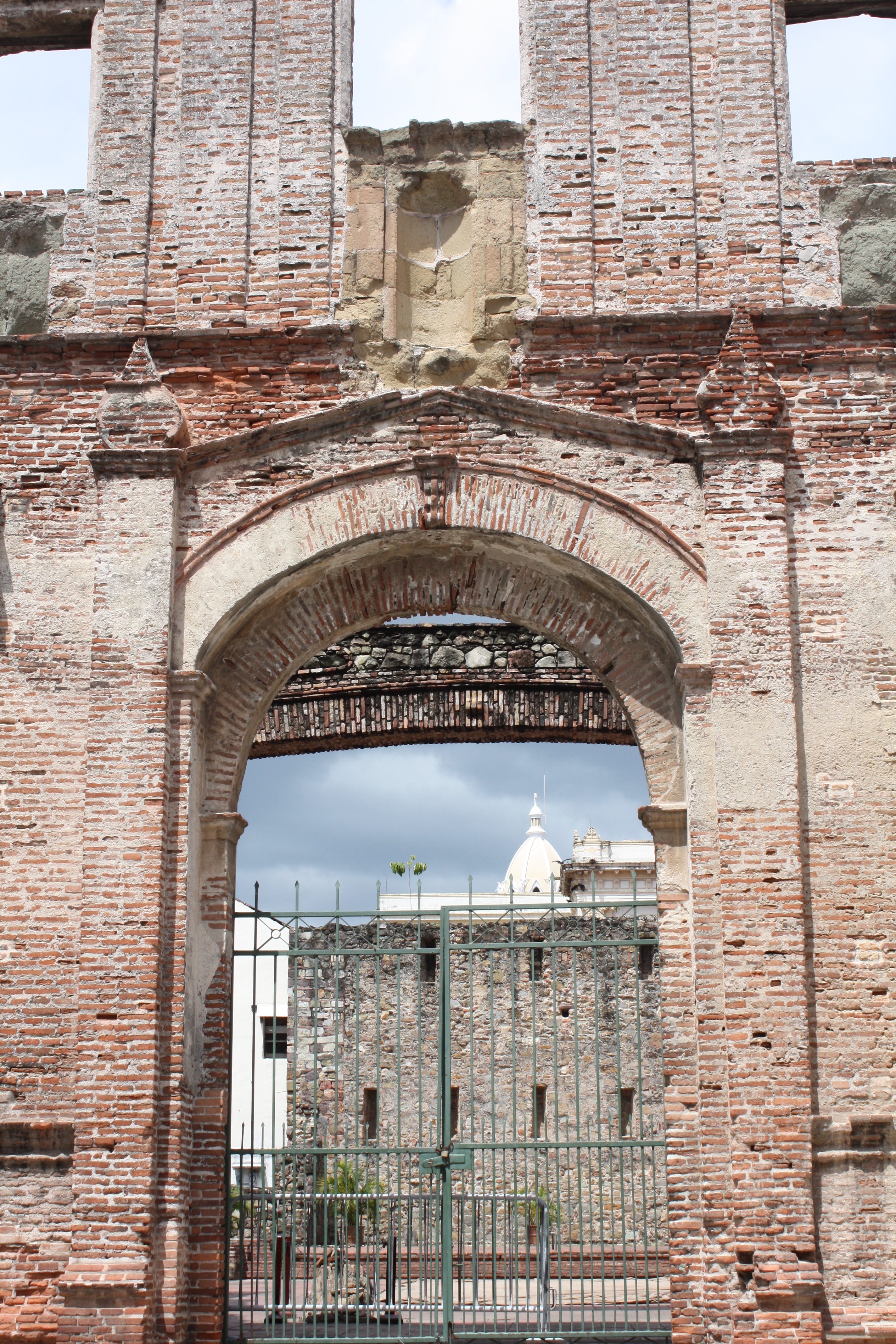
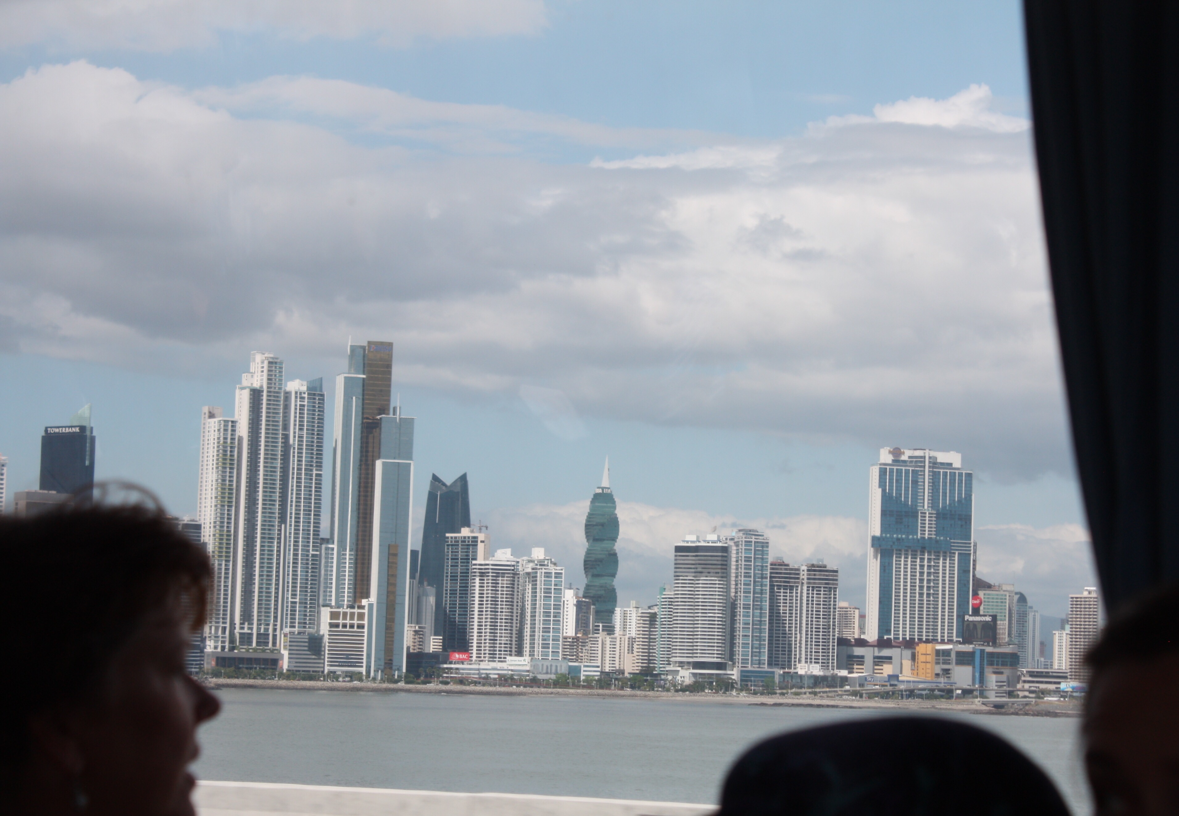
Panama City (new)With the new city behind us, we walk into the old Panama City.
Back in the bus…
The ‘spiral building’ made me think of Cerner, even though the building is of course not a double helix.
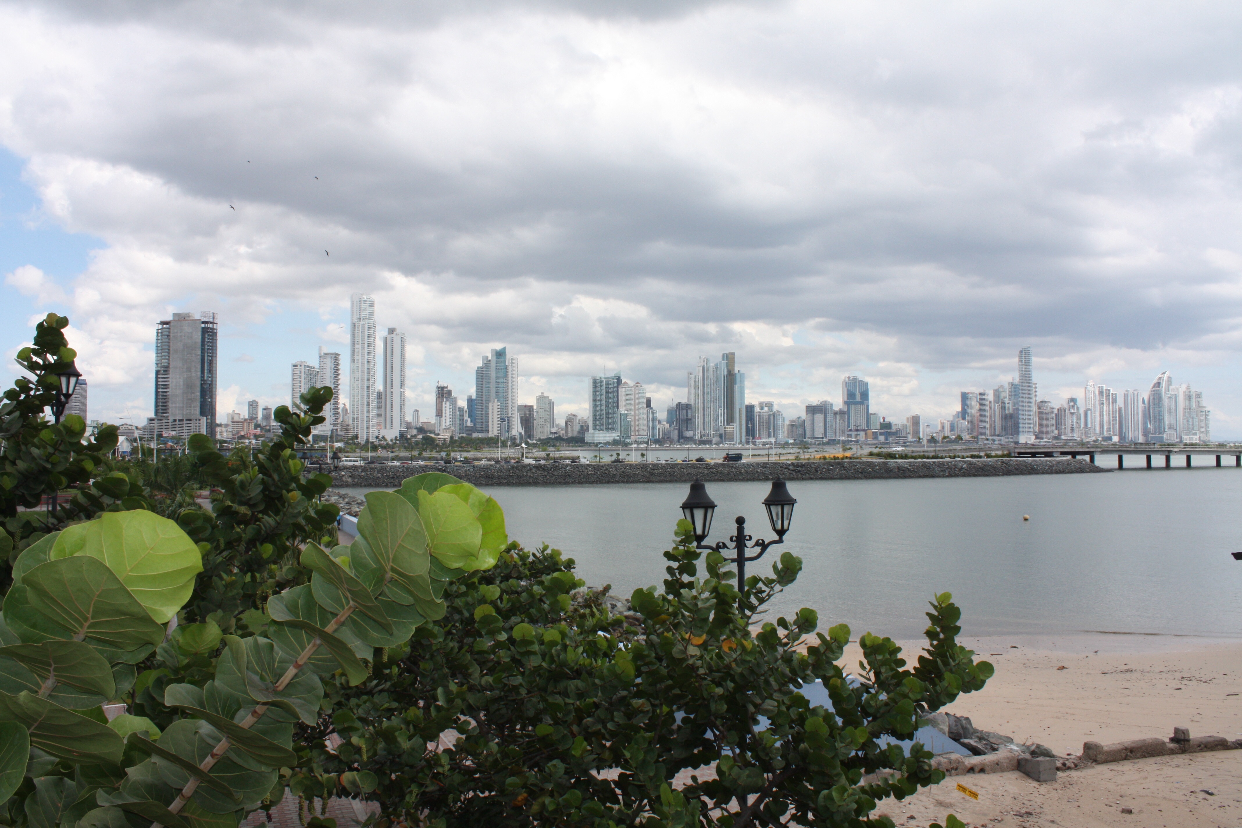
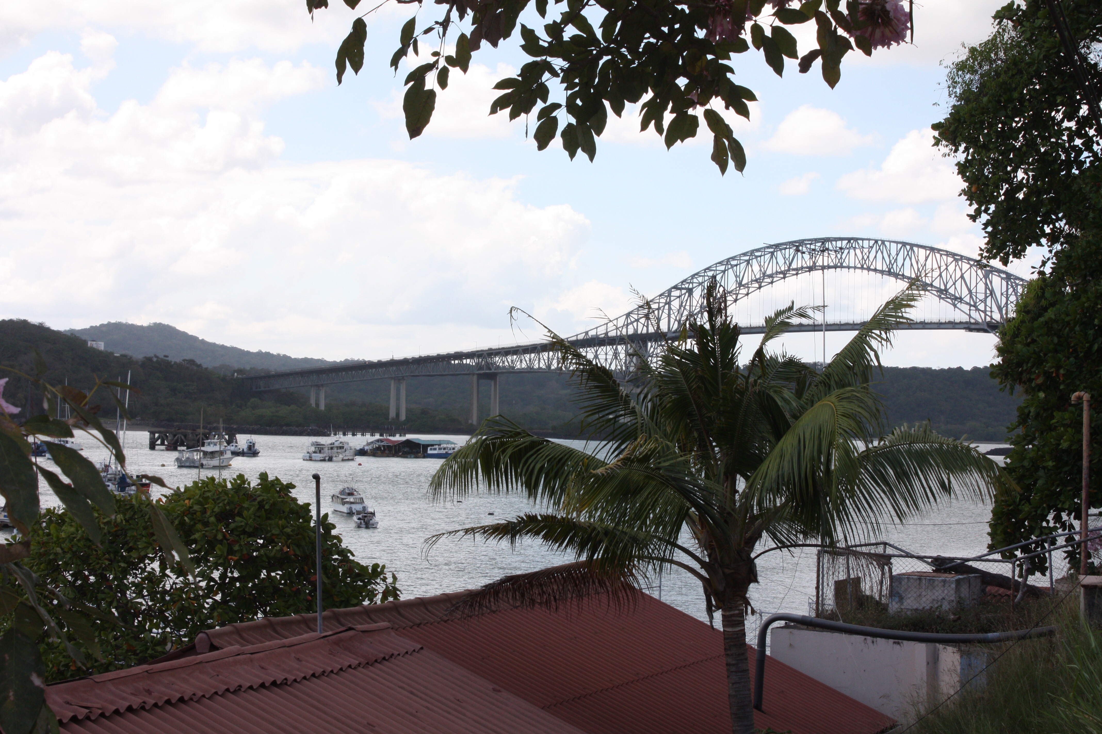
…to Balboa next, so we can see where we will be when we exit the Canal.
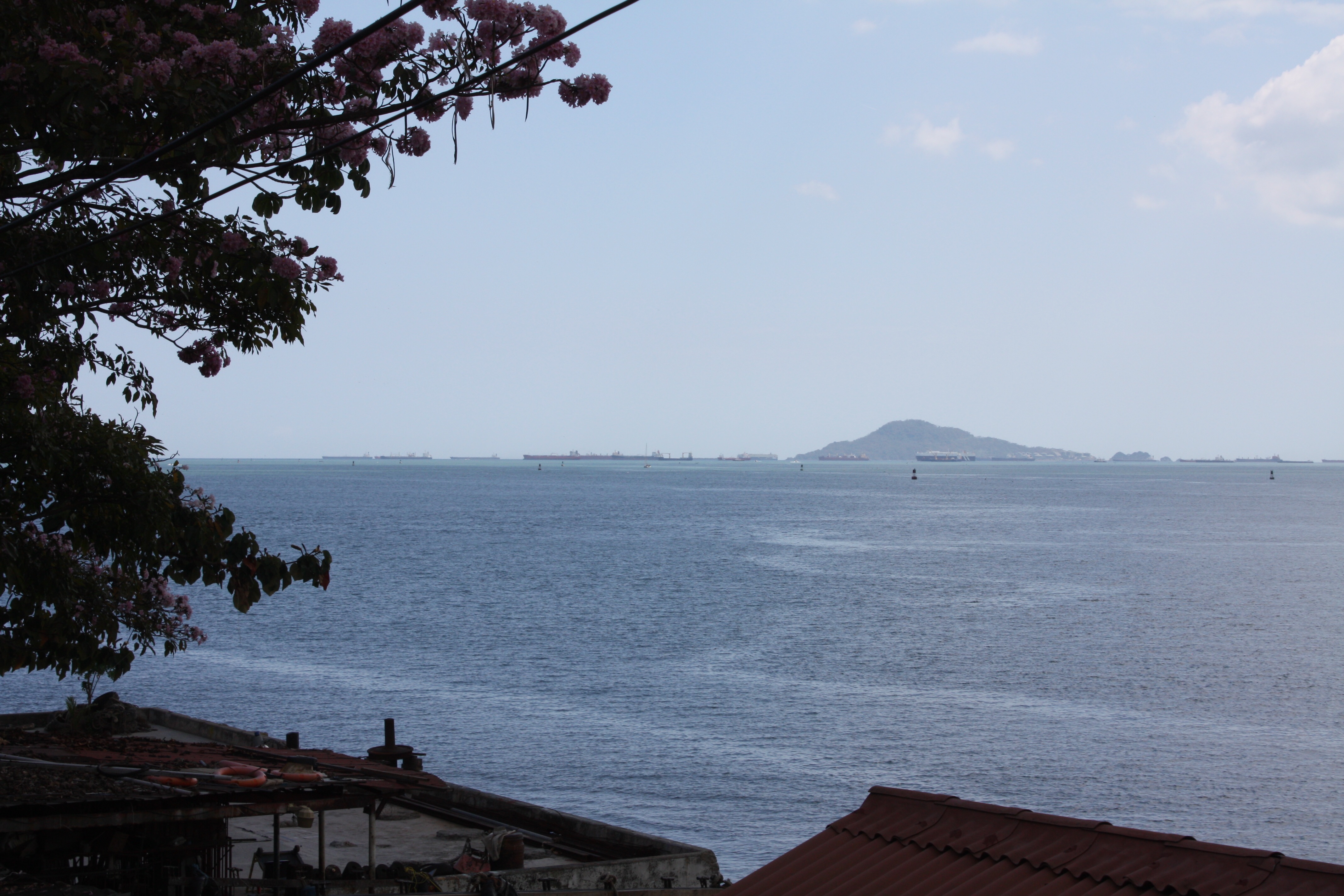
The Bridge of the Americas; effectively the Pacific end of the Canal.Ships anchored in the distance, off the Pacific end of the Canal.
Then after a short stop at a lousy cafeteria (and changing from shorts to “dress” pants), we’re on to meet with El Presidente of the Canal Authority. I considered taking a nap in the air conditioned bus, and skipping this meeting. But I’m very glad I didn’t! We met around a very official-looking conference table, with one person from each crew at the table, and others in chairs around the room. Enter senor Jorge Luis Quijano, who is a delightful guy and speaks fluent English (studied in Texas). After some pleasantries about sailing he asked if we had any questions. Tim (naturally) says, “I have a controversial one… Nicaragua…?”
I skipped Nicaragua in my introduction. They are (maybe) building a canal to compete with the Panama Canal. Our host had obviously addressed this issue many times, and it was interesting to hear what he had to say about it. The Panama Canal is a huge part of the Panamanian economy — extremely profitable, so of course they are paying attention to all the alternatives. There is the possibility of ships using the Northwest Passage. But despite the effects of climate change, this remains a risky proposition, where a ship might approach the area only find that the route is closed. Or worse, find themselves caught in the ice. There is Cape Horn, but that is very far out of the way, as well as being plagued by severe storms. And there is “the other way around.” I.e., travel from China to the US East Coast by sailing west, via the Suez Canal, instead of east via Panama. The latter option, especially, is primarily a time/cost/fuel financial calculation. Big ships, by the way, pay more than a quarter million dollars to transit the Panama Canal transit.
Senor Quijano was very diplomatic about the Nicaragua project. It will require excavating 10 times the amount of earth excavated in Panama in total over the past 130 years. The Panama Authority has a pretty good idea, based on very recent experience, what it takes to dig a big ditch. The Nicaragua schedule is to build it in five years. Senor Quijano says to accomplish that they would have to import half a million Chinese, and build all parts of it at once, which would add many challenges. And he asserts that there is not sufficient demand to support two canals, so if another one is built they will have a price competition, and thus the financial return expected in Nicaragua would probably not be realized. I am making no assertions about any of this, but I found what he had to say extremely interesting.
We then presented him with a Blue Planet Odyssey plaque, promised that Jimmy would invite him to his boat when Aventura arrives in March, and thanked him profusely for meeting with us. We all lined up in front of the room’s mural of the Canal for a group photo. (The official photos might show up on the BPO web site soon.) Senor Quijano then surprised us by presenting each of us with a “Canal de Panama” cap. Cool! Back on the bus, we sit in city traffic for an hour, and then an hour on the highway back “home” to Shelter Bay. Long day. Fabulous day!