Category Archives: 9. Indian Ocean

Cocos to Rodriguez, Part 1

Final prep… Went aloft to check rigging, and tightened a creaking nut/bolt that attaches the lower shrouds to the mast. Tightened the one for the running back stays, too. Noticed that the sheave at the masthead for the main halyard moves around a lot, probably worn where the pin goes through it. Don’t think this is an immediate issue, but something to add to the list for repair.

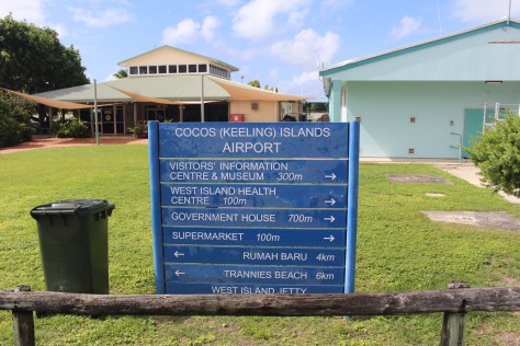
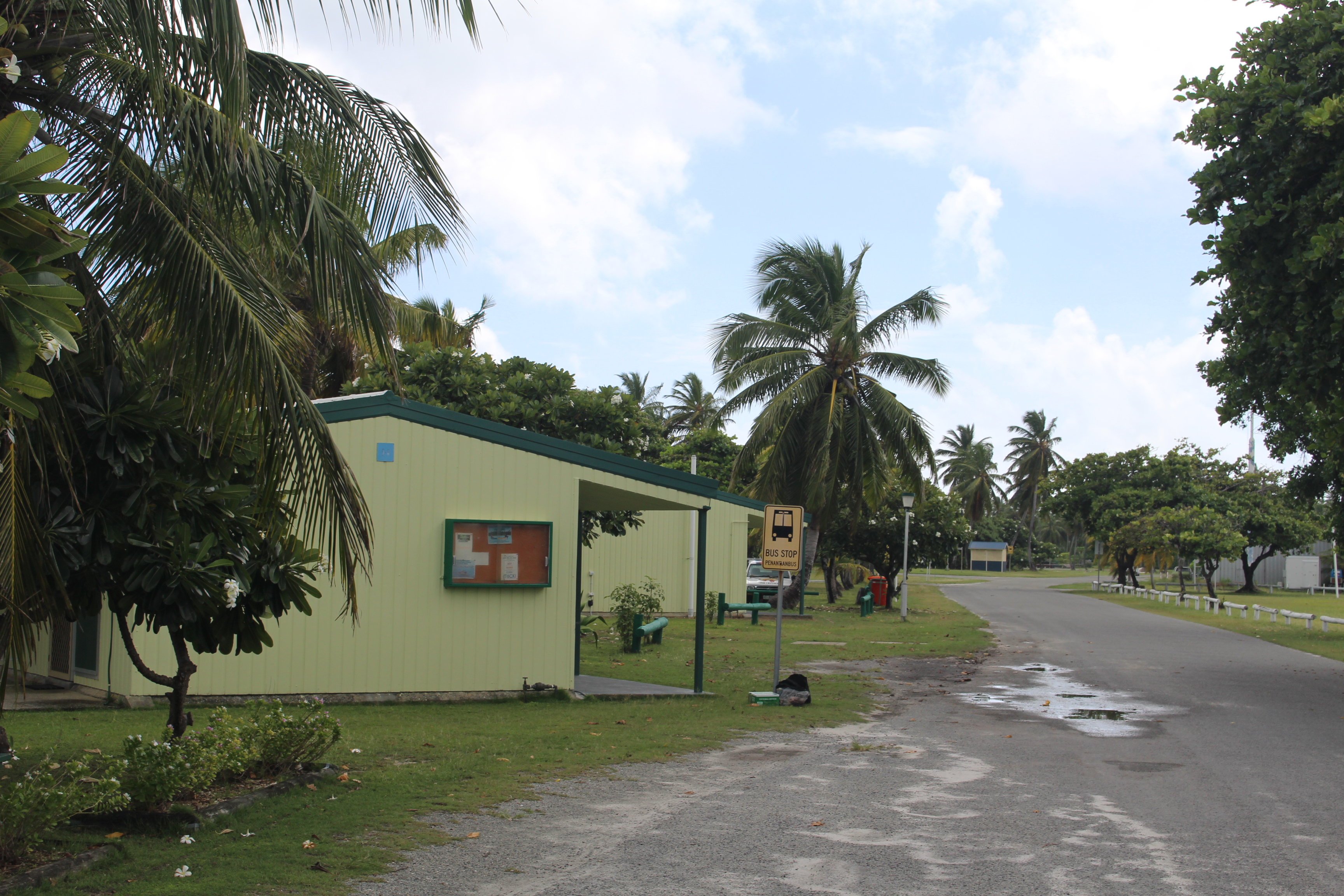
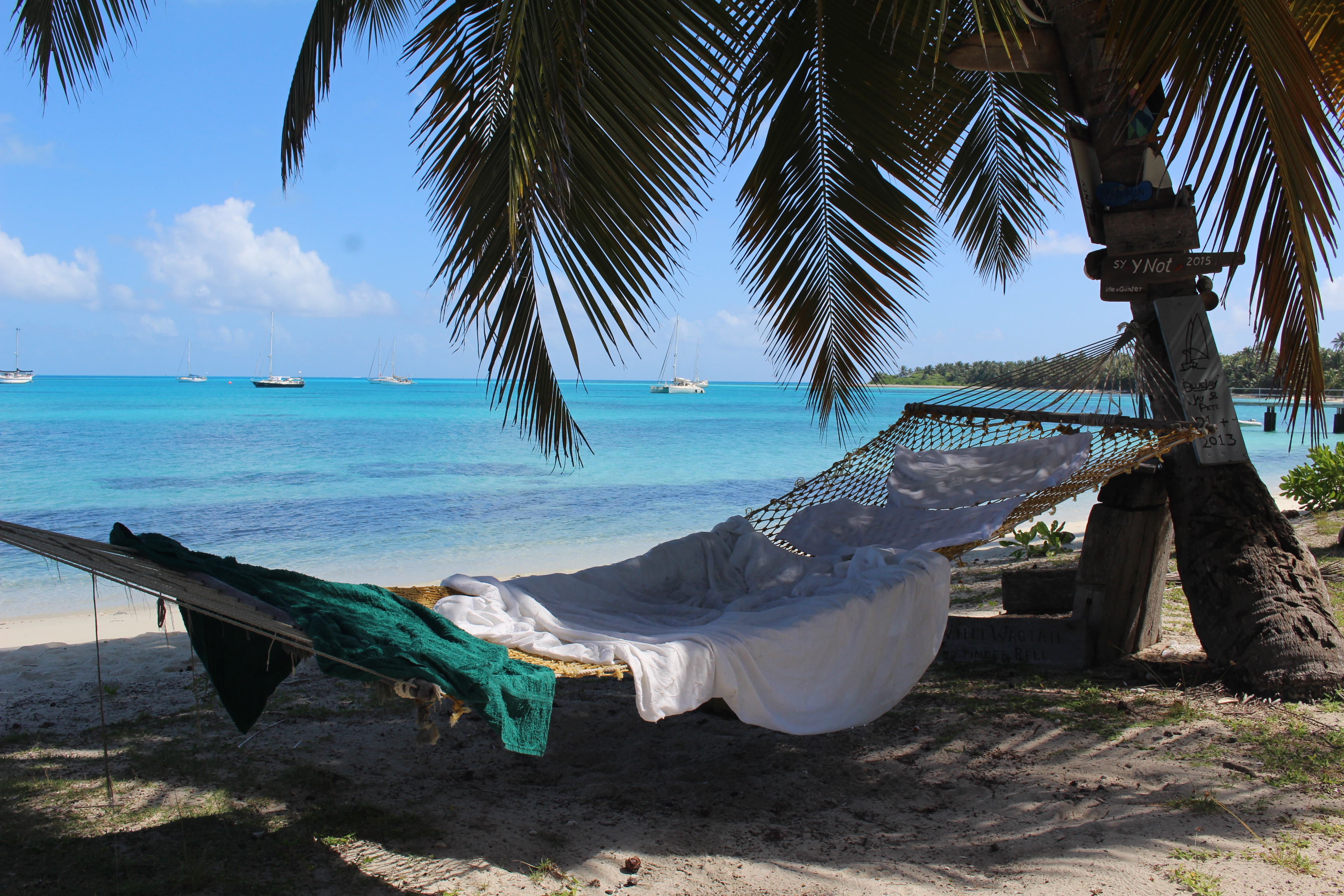
Dove to do a last scraping of barnacles, and noticed that we have a chunk missing from the bottom of one daggerboard. Not sure how/where/when that happened. Another item for future repair. Bought our expensive diesel. Filled a propane tank (also expensive). Got our fresh produce (not really fresh, since it is flown in from Australia; also expensive). Watched a movie with dinner the night before. Got our last Internet licks.

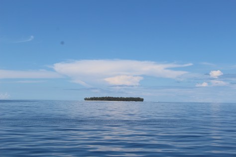
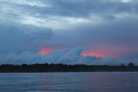
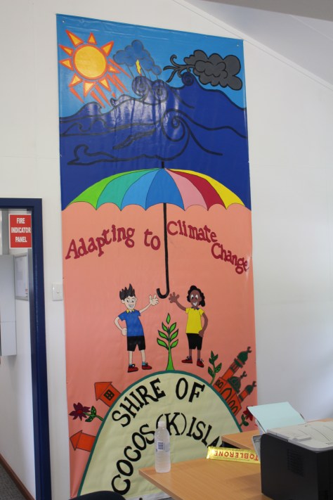
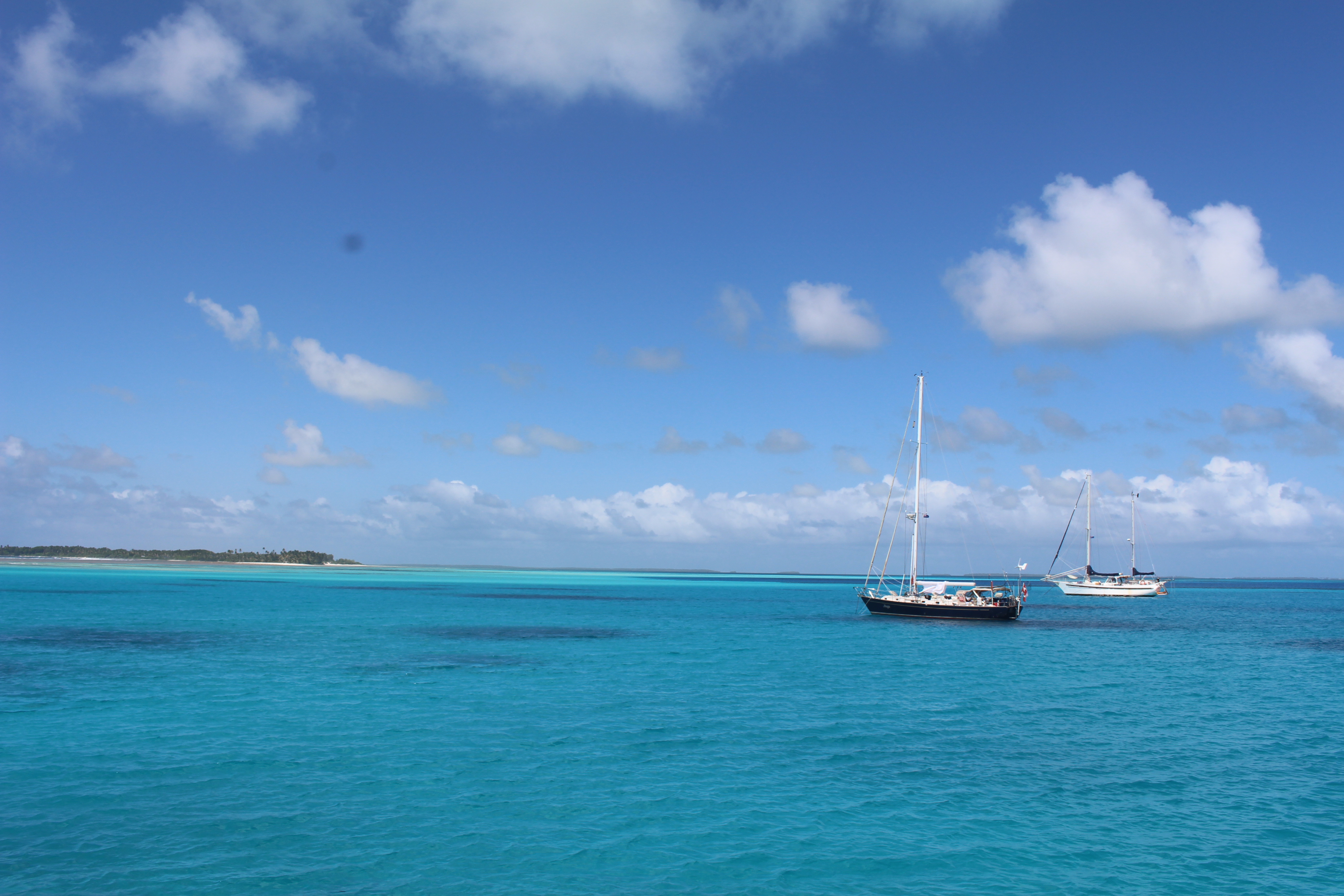
Day 1 – A twinge of sadness about leaving beautiful Cocos, and a little reluctance to leave the smooth anchorage for the open Indian Ocean…but…underway at 8am. Instead of Goodbye, they tend to say, “See you next time around!” We are setting our course due west, which is north of the direct path, because the wind predictions show a calm area ahead to the south. That area is expected to fill in after a few days; then we can adjust course to the south.

It was only one hour underway when our first casualty occurred. Our computer died. The most important function of the computer, at least at sea, is to control the modem that allows us to send email via the radio. Luckily, Tim had his spare laptop, and had loaded it with the software. So we can still communicate (and send this text to Hallie to post to the blog).

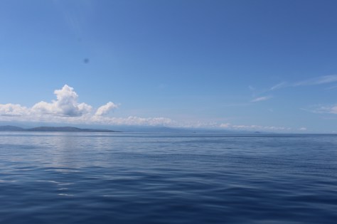
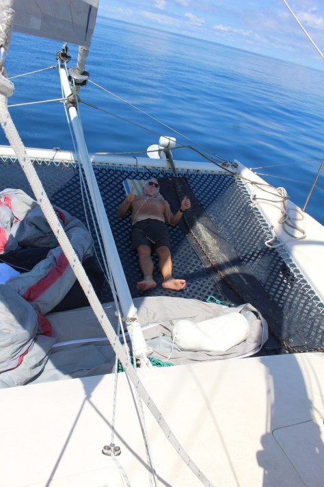
It has been a good first day. Winds mostly about 16 knots on our quarter. Relatively small seas; relatively small swell coming up from the Southern Ocean. It’s great to have a peaceful day for adjustment to the motion of the sea.

Day 2 – Near perfect sailing. Wind about 14 knots on the quarter. Flew our spinnaker most of the day, thought we brought it down for the night. We are very, very lucky to have these mild conditions up front. Lots of birds; lots of flying fish.

Day 3 – We had a bird (shearwater?) land on our bow last evening, and during the night she moved back toward the cockpit, about six feet from where we sit. She preened for hours, then tucker her head under a wing and snoozed. In the morning she flew off for ten minutes, then landed on the bow again. Until we put up the spinnaker, and had to run a line near her — then she left.

We had some major spinnaker excitement. We were setting our asymmetrical, and the sock was difficult to raise. We had all our attention on the situation aloft, and didn’t notice the wind starting to fill the sail with a wrap in it. We couldn’t get the wrap out; the sheets were twisted together so we couldn’t ease either; we couldn’t get the sock down; so we had a mess. We lowered the halyard and managed to pull the sail aboard before it dragged into the sea. The hoop at the bottom of the sock was broken. Don’t know for sure if that was a cause or an effect of our struggles.

So we stowed that spinnaker and broke out the old Parasailor (which is no longer a Parasailor since we repaired its latest tear by removing the wing and filling in the slot with solid fabric). This time the sock control lines got twisted/jammed/fouled. The spinnaker was flying okay, but the sock was not right, and one of the control lines was yanked from my hands and swinging up out of reach. We managed to grab it with the boat hook, and pull the sail down, half socked. Then we raised it in its sock again, and sorted everything out as it went up. The sail worked beautifully — if anything being more stable and more effective than it was when it had the Parasailor wing!

It’s been another beautiful sailing day, and we were tempted to leave the spinnaker up tonight. But after the reminders of how things can go wrong with spinnakers, we decided to switch to the screecher. This change reduces our speed by a knot or slightly more, but we are keeping apace with Maggie (we are about 15 miles ahead of them), so no need for speed.

Day 4 – Beautiful day, but not enough wind. Our noon-to-noon distance runs so far have been pretty feeble: 138, 142 and 132 (nautical miles between actual noon positions). But late this afternoon we got a nice breeze from the south, and the sailing is good for now.

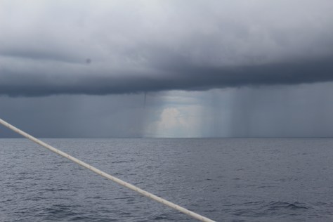
We received an email around mid-day from Chris, the singlehander aboard Tom Tom. He reported that his forestay had parted, and although his mast was still standing he was in rough seas and had concerns about it. He had rigged several lines to provide support to the mast, but everything was tenuous in the rough conditions. We let him know we are headed in his direction, but we are 575 miles behind him. He appreciated our being “there” even if “there” is four days away. This evening I got on our SSB radio net (a loose association of boats crossing the Indian Ocean and checking in on the radio daily), and spoke with Alicia aboard On Verra. They are only 25 miles from Tom Tom. But they don’t have email at sea. So they offered to alter course toward Chris, and try him on the VHF radio as they get closer. Chris is still sailing, with greatly reduced sail, and he is not asking for assistance at this time. Hopefully he will be able to sail slowly into Rodrigues, but we will try to “have his back.”

Cocos (Keeling) Islands

This place is unlike any place we have been. For starters, what place has parentheses in the official form of its name?! Cocos is two atolls, 15 miles apart. The northern one is small, no harbor, no people. The southern atoll is a ring of islands around a lagoon four miles across. Three islands are of importance — Direction Island, Home Island and West Island. Culturally, each is entirely different from the others.

Direction Island is where we are anchored — in fact, it is the only place where yachts are allowed to anchor. The anchorage is beautiful and well protected, and the island has the nicest beach of the atoll. But nobody lives on Direction Island. Twice a week a ferry comes here from Home Island, two miles away, and brings people who want to “go to the beach.” There are several little shelters…walking trails…a big cistern of rainwater…a few hammocks and beach chairs…a barbecue hearth…and a wifi internet router that we can access right from the boat… Except on ferry days, it is just us yachties. No fishing boats, nobody paddling out asking for handouts. Just sitting on the boat in the trade winds and gazing at the beach and palm trees is delightful.

Home Island is where the people of Malay descent live — about 500 people, very Muslim. There is a well stocked grocery store, though prices are high — a banana costs about $2. There is a restaurant that opens on certain nights if there is enough interest…a post office…a bank that opens for a few hours a week…a primary school…the Shire Office, where we pay $50 (Australian) to anchor here for a week…a marine services building with impressive tools and equipment…a crafts shop that they opened for us when we showed interest (but nothing compelling inside)…several other little shops…and a fuel depot that opens at 7:30am for one hour twice a week, and two hours on Fridays. No cars, but some golf carts and motorbikes and 4-wheelers. The pace is pleasantly slow.

Then there is West Island, with ferry service from Home Island half a dozen times a day ($2.50 each way; half hour ride). About 150 people live on West Island, most of them white, most of them government workers and their families, and ex-government-workers who liked it here and didn’t go back home to Australia. There is an airport with a few flights per week. (And apparently the USA would like to base a fleet of drones there.) There is a well stocked grocery store…some tourist shops (but not many tourists; as TC says, most Australians have never heard of Cocos)…a “hotel”…not much else. It all seems rather unreal…artificial…out of place. It’s all pretty high end, over-infrastructured. There is a bus that makes three stops, mostly because the ferry landing is several kilometers from the “town.”

The division between the Malays on one island and the Aussies on the other, plus the yachties separate is…well…interesting. I don’t mean this in a negative way. It was an interesting history that even got this atoll inhabited in the first place, and then its strategic geographic importance gives it additional unusual history. You might want to read about it on Wikipedia. The Malay people originally were brought here in the 1800’s as a harem (and slaves) for a white sea captain who wanted to create his own little world apart. The recent incorporation into Australia was agreed to by a close-to-unanimous vote.

We are 600 miles from the southern tip of Sumatra, and 1100 miles from Western Australia.

@@@@@@

To get to Home Island we have to take the dinghy two miles through waters studded with coral. We managed to find our way through it all until we grounded 50 yards from the jetty! Later in the day I noticed that there was a lot of water in the dinghy. But it might have been the combination of rain showers plus the spray we shipped on the two mile ride back. So I just pumped it out and forgot about it, until I was in bed and almost asleep. I got up to check, and found four inches of water aboard! After pumping it again I lifted the dinghy on our davits for the night.

I feared in the morning I would look under the bow and see a big crack or a hole, and we’d have to figure out a way to epoxy it before we could go anywhere. But I saw no damage under the bow. So we dumped several buckets of water into the boat to see if it would leak out. Sure enough, it appeared that the drain plug in the back was dripping. The plug has always felt rather loose, so we wrapped tape around it, like you might do on a plumbing joint. But it made no difference. Closer inspection revealed that it wasn’t the plug, but the fitting it plugs into that was leaking. It was tricky to take that fitting apart, but we did it and we drew upon out vast collection of O rings to put it back together with no leak. Fixed — in time to still dinghy into Home Island and catch the ferry to West Island for our exploration there. Apparently it was pure coincidence that the leak developed on the same day when we grounded the dinghy.

@@@@@@

Another little coincidence: I took advantage of the rainwater ashore, and I shaved for the first time in 6 weeks. Later I put on my dive mask so I could scrape the barnacles off the bottom of the boat. With my beard gone, I expected to have an improved watertight seal of my mask against my face. Instead I found that water was rapidly coming in, and I couldn’t get a good seal at all! How weird that shaving would have that backwards effect. But later I took a closer look at my mask, and discovered that the purge valve had come loose. It was a five minute fix.

@@@@@@

Today is fuel day. Since we motored so much before we picked up the trade winds, we want to get some diesel. The cost is nearly $8 (US) per gallon here, but I’d rather not be worrying about running out on our upcoming passage. It isn’t easy to get, though, since the depot is only open from 7:30am to 9:30am today (it’s Friday, when they stay open the extra hour), and we will have to make two dinghy trips to get the 20 gallons we want. Plus we will have to buy petrol/gasoline to fuel the long dinghy rides.

Then we will attempt to check out, so we are free to leave over the weekend, when the police won’t be working. The police boat is nearby checking a yacht in (five more boats have arrived since Maggie got here!). The police say they will stop by after to clear us. And today is laundry day. I’m going to take my bedding ashore to wash in the rainwater, as it is a good drying day today. (Now that the squalls have gone away, it is beautiful beautiful beautiful here.)

Tomorrow is shopping-for-produce day. We are told that a freighter arrives today with produce, so tomorrow morning is the time to stock up. We want a two week supply for our run to Rodrigues.

After shopping we might leave. No hurry though…maybe we will stay another day. Our mooring fee and our internet fee are both for a week, so staying another day is “free.” We will study the wind predictions, but I don’t think a day will make much difference, one way or the other. We’ll see what Maggie wants to do…

@@@@@@

I feel so GOOD here! The air temperature is warm, but the constant wind feels cool. The anchorage is protected, the holding solid — makes for sound sleep. Shaving makes me feel lighter, as does cutting my hair, which I did just before leaving Padang. Our needs for food and fuel, and for dealing with the authorities, are getting met. It is quiet — we are far from the generators and the mosque in town. The things that have been going wrong are getting fixed quickly. We splurged and bought a case of expensive beer. The good internet has allowed me to get my “fix” of online Scrabble with Hallie. Swimming is wonderful, the water clean and clear (and the sharks are pretty small and don’t bother you). The air is clear and clean. I now have clean sheets and pillow cases. I washed my hair. My body feels good; my soul feels good; no worries; no hurry.

@@@@@@

image
Motoring out from Sumatra


image
Motoring out from Sumatra


image
Listening to audiobooks, staying in the shade, motoring out from Sumatra


image
Hard to see, but there is a skinny waterspout to the left of the break in the rain


image
Still leaving Sumatra…


image
Our anchorage in Cocos


image
Nice to be welcomed!


image
Some of these, such as “shopping center,” are overstated…


image
Kids’ mural in the Shire Office. Not sure how much an umbrella will help in adapting to climate change, but interesting…
Ferry
Ferry


image
Switching to West Island now…downtown


image
West Island events/news


image
West Island


Bus stop, by the hotel


TC doesn't like having his photo posted, so this might be he with Tim waiting for the bus.
TC doesn’t like having his photo posted, so this might be he with Tim waiting for the bus.


School
School


Walking along the airstrip I was surprise to see a radar speed feedback sign (over-infrastructure?), and further surprised that it told me I was walking at 5 KPH!


...and surprised again when it gave me a happy face, presumably because I was not exceeding the speed limit!
…and surprised again when it gave me a happy face, presumably because I was not exceeding the speed limit!


Recycling is big, but they don't allow us to take any waste ashore, so not for us.
Recycling is big, but they don’t allow us to take any waste ashore, so not for us.


Bob is back, aboard Maggie again this time.


image


The police come to the boat for clearing in and out.


Back to Direction Island


Direction Island
Direction Island


Yachties leave their 'signature' on Direction.
Yachties leave their ‘signature’ on Direction.


Drying my laundry
Drying my laundry


Black-tip shark alongside the boat


Strange looking customs patrol ship shared our anchorage, and the young crew came ashore at Direction to get an hour of Internet.


Maggie
Maggie


Padang to Cocos Keeling

Cocos Keeling is a small group of islands 700 miles SSW of Padang. They are under the jurisdiction of Australia. They are by no means on the direct route to Mauritius/Rodrigues, but you have to sail south anyway to pick up the trade winds, so it is perhaps 300 miles out of the way. We hope to sail there, but it depends on the wind. Particularly once we reach the trade winds — whether they blows from the east (good) or the south (bad). If the latter we would likely give up on CK, turn west, and go the remaining 2200 miles to Rodrigues (which is part of Mauritius but 400 miles closer).

Day 1 – Departed 7:30am, motored all day toward Macaronis Resort in the Mentawai Islands west of Sumatra. Half way there at nightfall. Thinking we might get a last restaurant meal, or at least a cold drink, and possibly top up our diesel, on our way out to sea.

Day 2 – Made it to the resort mid-day. We tried to sail a few times, but always the wind died, so we motored almost the whole way. Hate to be burning our fuel so early, but we should get more wind as we go. The resort was very nice, and we bought fancy drinks and had a good “western” meal with our last Rupiah. We will leave at daylight. The plan was to meet Maggie 50 miles south of here, and anchor so they get a good night’s sleep. But the wind forecast says we should leave and keep going. Unfortunately we couldn’t reach them on the SSB radio tonight, so we can’t have a chat about that. We sent them an email (by radio); we’ll see how they respond…

Day 3 – Did our rendezvous with Maggie, and they agreed to keep going. At last we are headed out to sea! Convivia, Peregrine and On Verra were all anchored nearby, but they decided to wait. Their requirements are a little different from ours, in that they don’t plan to go to Cocos. I’m afraid we may have already missed the favorable wind. We are motoring once again into the night. But it is wonderful to be at sea. The well-worn Indonesian courtesy flag down. The air and the water a little cooler. The Sumatran islands fading on the horizon. Lots of wonderful memories of the delightful Indonesian people, in spite of my desire to move on. We are at 3 degrees south latitude. The trade winds should fill in at about 8 south, 300 miles from here. Cocos is at 12 south. We need some wind…

Day 4 – For several hours we had good wind. But now at nightfall we are motoring once again. It has been an overcast gray day, which is a good thing, but a side effect was that I didn’t know what time it was. I misread the numbers on my watch, and had dinner ready at 3pm! But it was yummy still at 5:30. We crossed 5 degrees South latitude.

Day 5 – At 6am there was a brief squall, and then the wind came up from the SE. Could this be the edge of the trade winds already?? That would be too good to be true, as we had not yet crossed 6 degrees South. The forecast shows light winds in this area from every direction. But we were on a close reach directly toward Cocos making 8 knots, sometimes 9. Will it hold…????

Several hours of good sailing, and then it petered out. Multiple squalls with near calm between. Frustrating, but still to be expected here. Motoring again at nightfall. We are half way from Padang to Cocos.

Day 6 – Motorsailed most of the night, then about 9am we had a good sailing breeze…from the West! That’s backwards. The wind became SW and lighter, so back to motorsailing. At 2pm we crossed 8 degrees South, where we think we can legitimately expect trade winds. But still we had wind from the SW, plus swells and waves in multiple directions. Quite uncomfortable. At 4pm we could see that the clouds overhead were moving in the direction of the trade winds, even though on the surface we still had SW. The waves were causing the sails to bang and slat so much that we dropped them and just motored. At nightfall the wind had shifted to South (right in our face), but still light and we are still motoring…

Pan-fried chicken and watermelon for dinner. And TC has made two banana loafs to use up our overripe bananas.

Day 7 – It rained off and on all through my 4 hour night watch, still motoring. Crossed 9 South around midnight. And then just before Tim came on at 3am, a big line of rain clouds passed overhead, and the wind started to build from the SE.

When I woke up 4+ hours later, Tim said, “Come out and behold the majesty!” The morning was indeed majestic. Wind getting up to 20 knots, seas up to 4 meters, patches of blue sky between gray and white clouds, pelagic birds soaring by with their wing tips inches from the waves, and No Regrets surging along at 9 knots. Trade winds at last! It’s a bumpy ride, but a welcome one. Now with double reefed mainsail and working jib, we should have no problem arriving at Cocos tomorrow.

Made my first ever tempeh meal. (Tim announced a couple weeks ago that he no longer eats mammals.)

Day 8 – Squalls all night. Wind from 5 knots to 35 knots. But in the morning we arrived. Beautiful spot, though not much here. Nothing visible from the boat, but we are told we can buy very expensive diesel, and that Friday a freighter will arrive with fresh produce, so we should provision Saturday morning. In the meantime things are going to be rather quiet. Maggie should arrive before dark. Our old friend Chris aboard Tom Tom was here, but has already left for Rodrigues. One other boat here. Got wifi right in the anchorage though, from a hotspot on the beach!