Catching up on photos…


Catching up on photos…
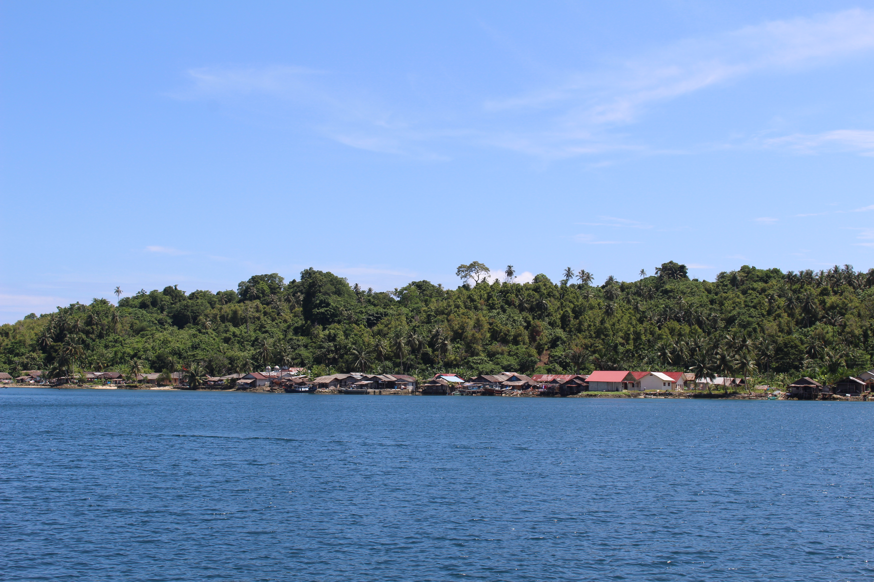
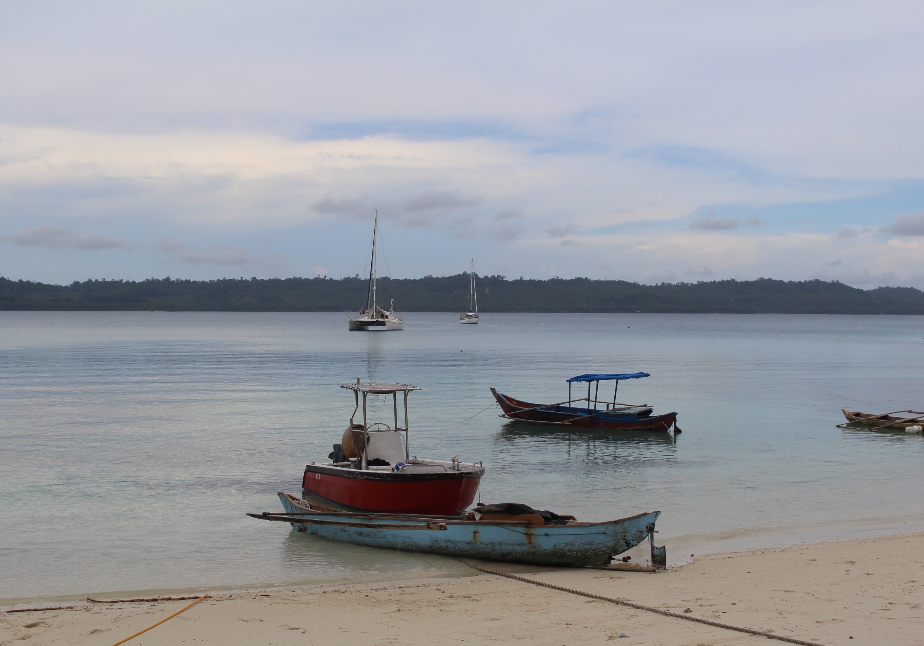
On one side of the bay, near where we anchored, is a river that we had heard leads to a Mentawai village. On the other side we can see a small working port, with a tugboat and a ferry and a few larger fishing boats. We wanted to explore the river. Our friends on Gaia were here two days ago, and told us via radio that the river has three paths — the left is pretty, just jungle. The middle peters out. The right takes you to the village.
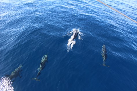
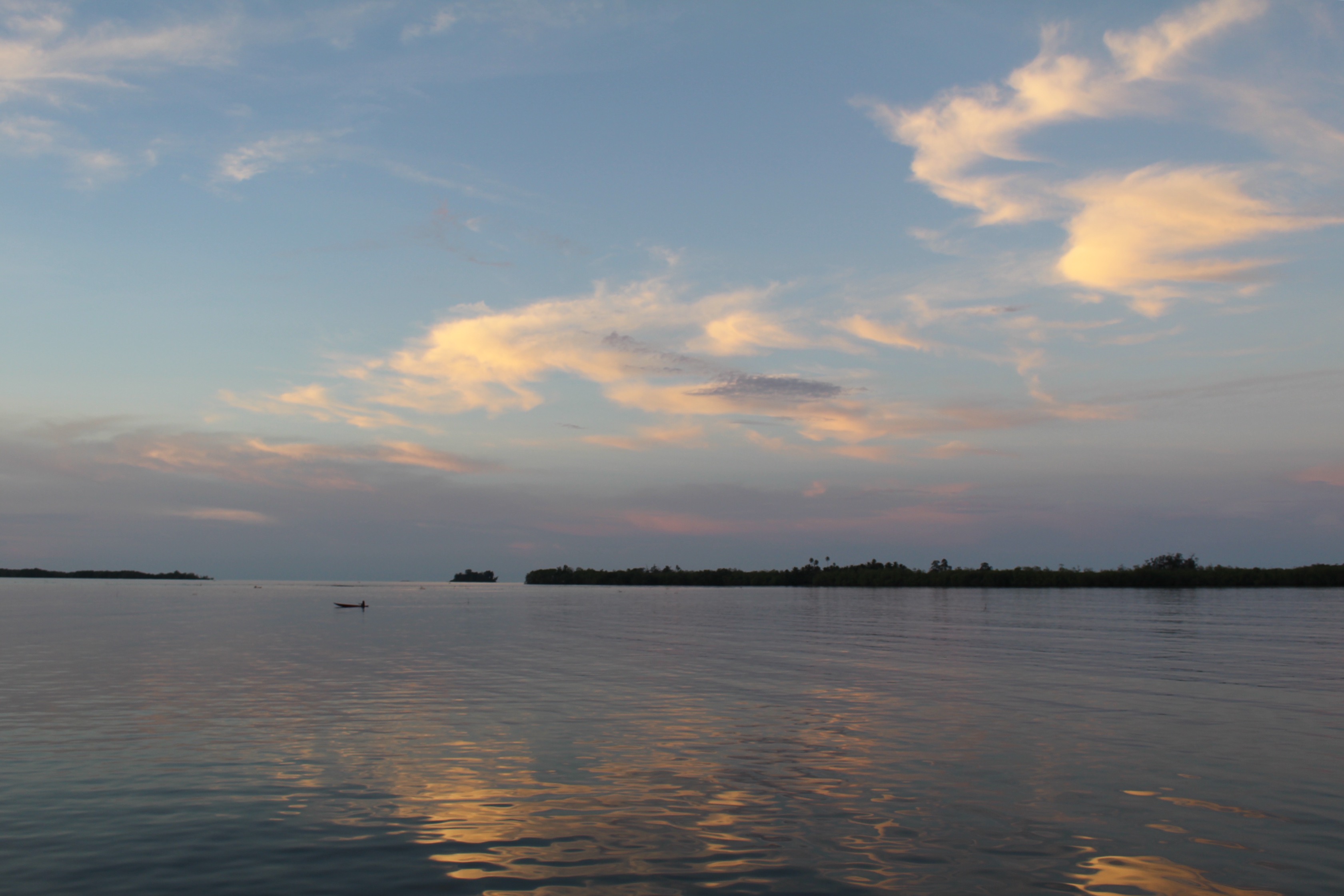
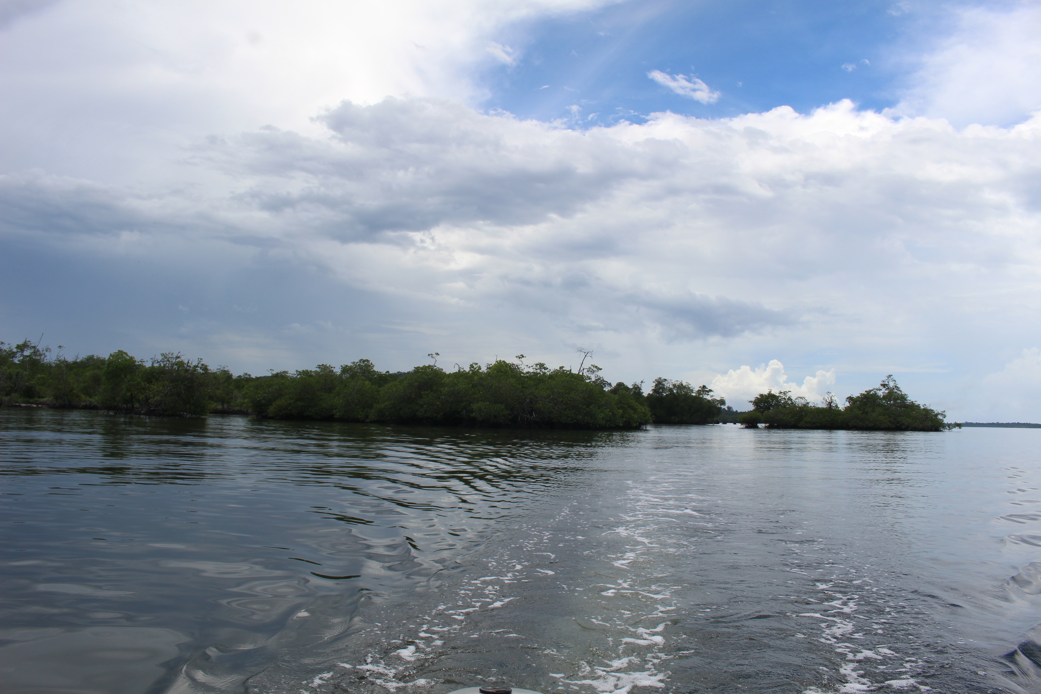
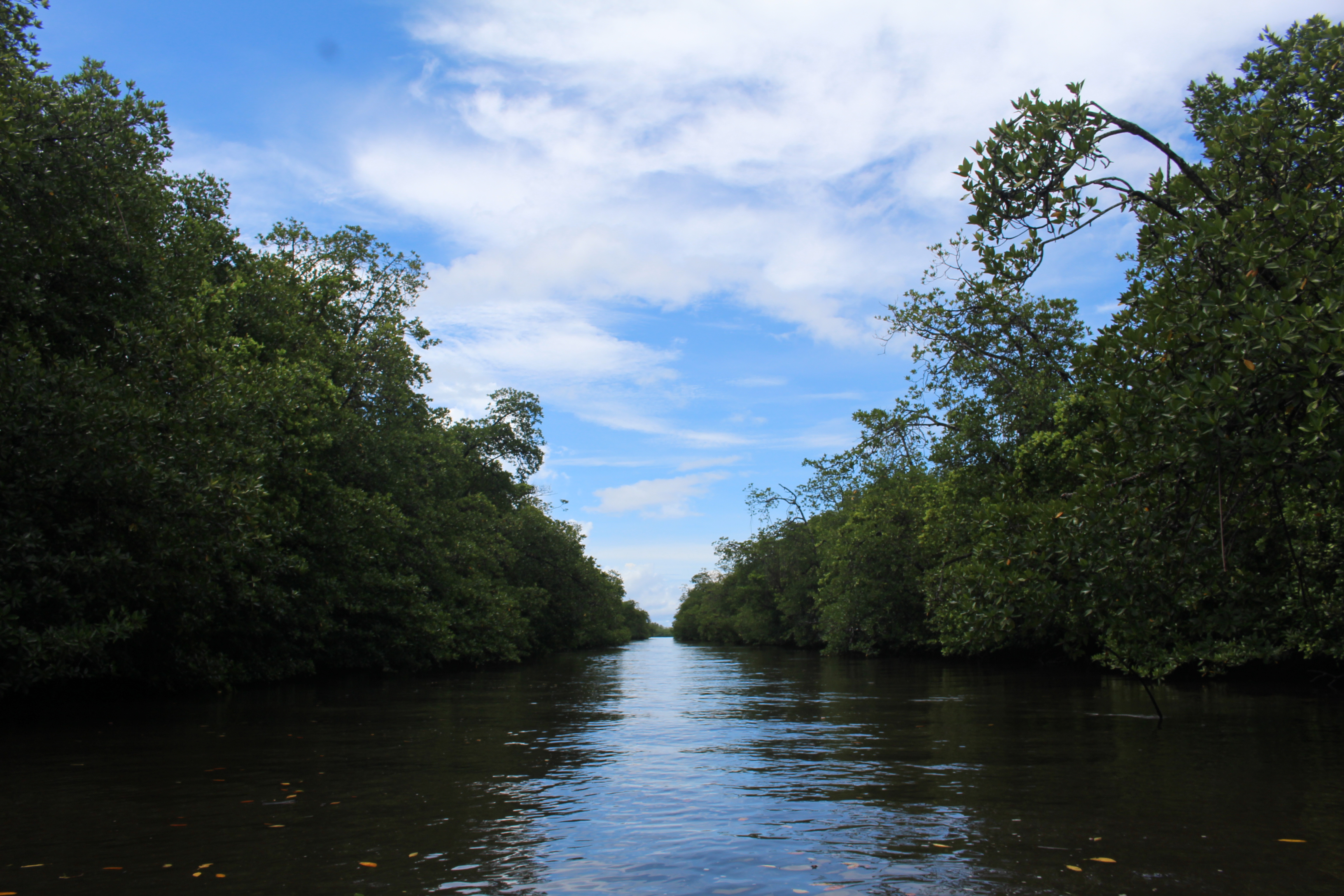
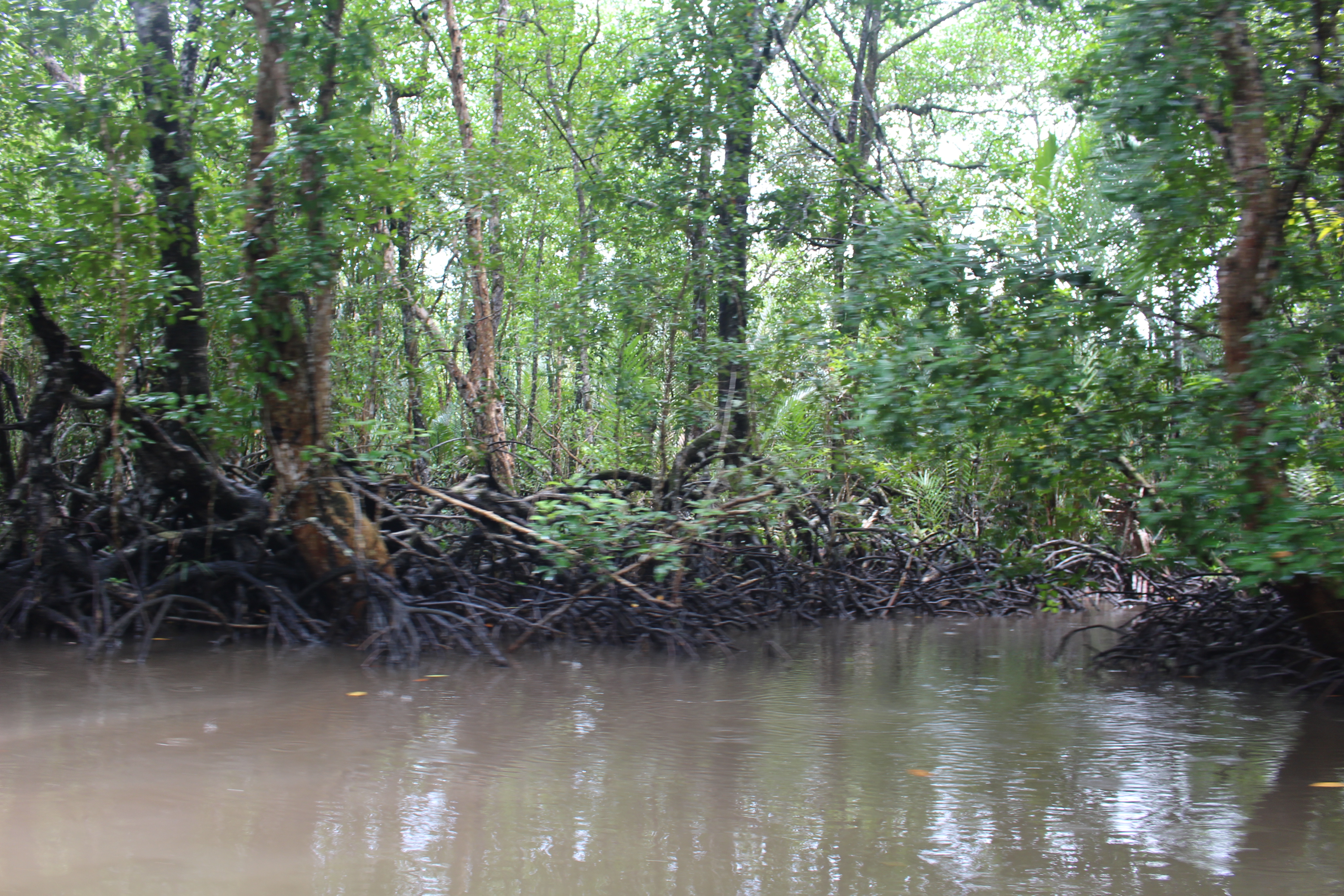
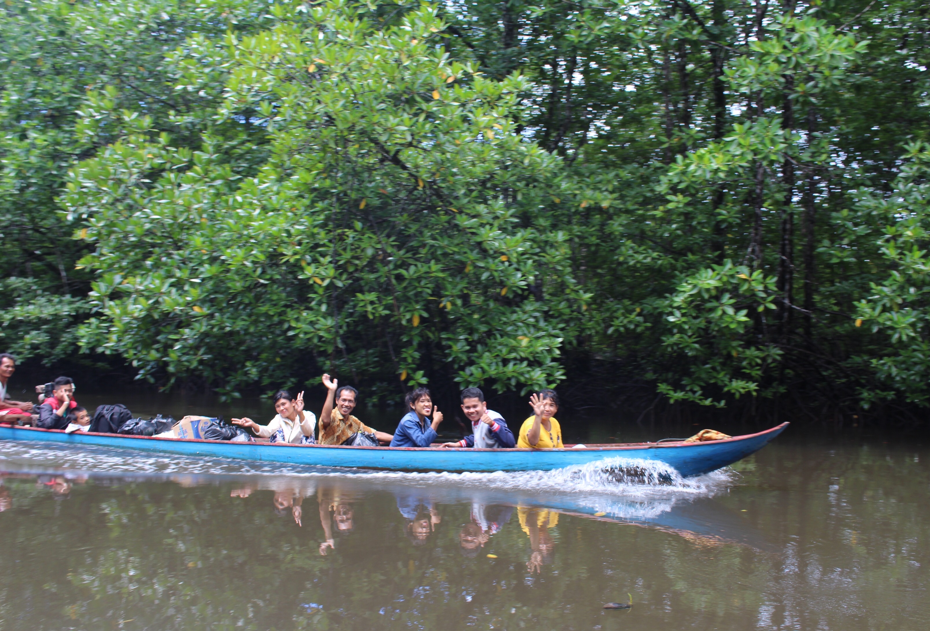
When the morning rain subsided, we decided to try for the village. But first we had to find the mouth of the river — hidden among the mangroves. We found an opening, but we didn’t know if the three paths had separate mouths, or if we would encounter forks upstream. In any case, upstream we went. After maybe a mile we passed a boat coming down. The men aboard smiled and pointed upstream, so we judged we were on a good path. In another half mile there was a fork, so we stayed right, even though the larger flow seemed to be left.
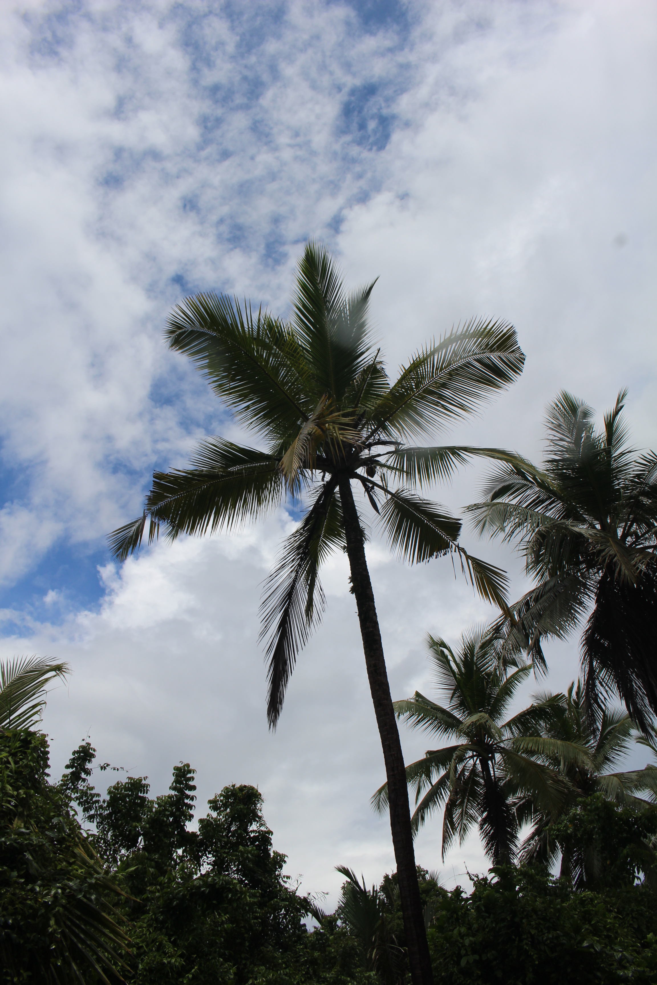
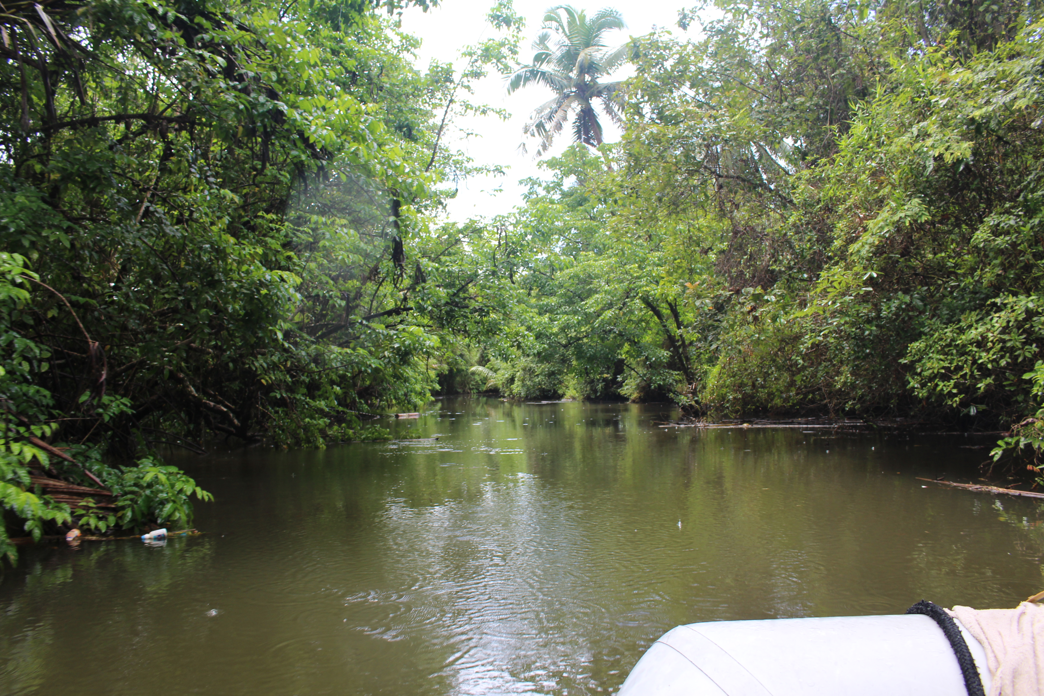
The mangrove banks gradually changed to pandanus and coconut palms. The channel got pretty narrow, often less than 30′, which had me doubting that the large canoe we saw had come down this way. But it was still deep, and on we went. We saw a man getting out of a canoe, and slowed to speak with him. He just pointed upstream, and from that point we could see a little dock. We tied the dinghy and stepped ashore.
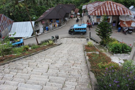
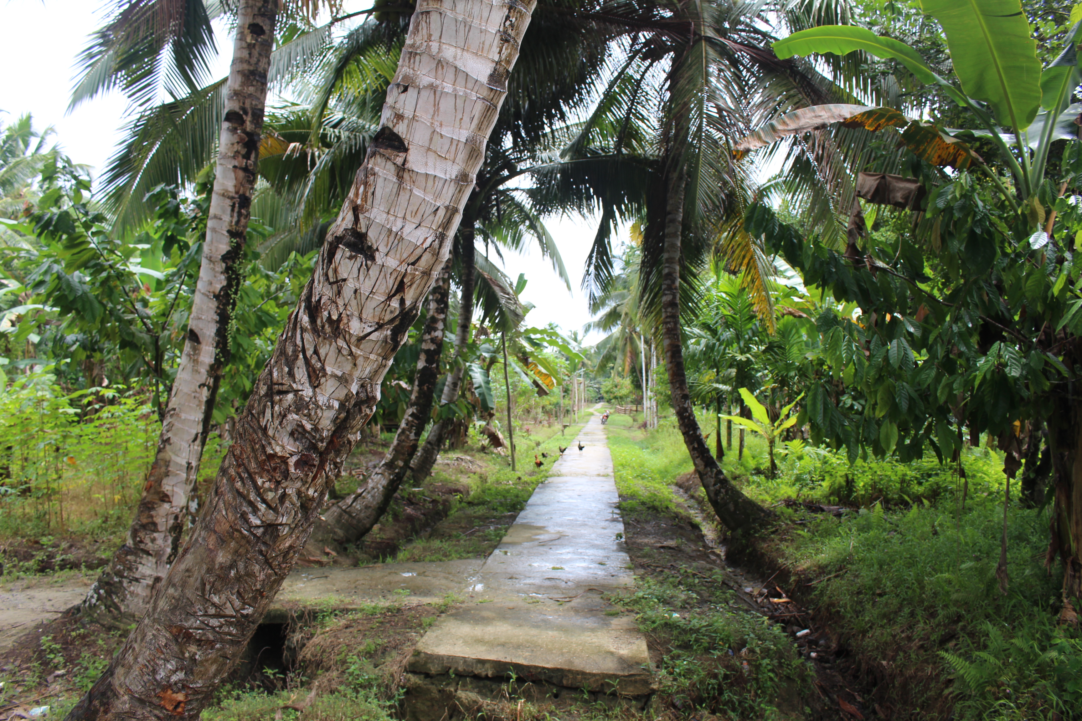
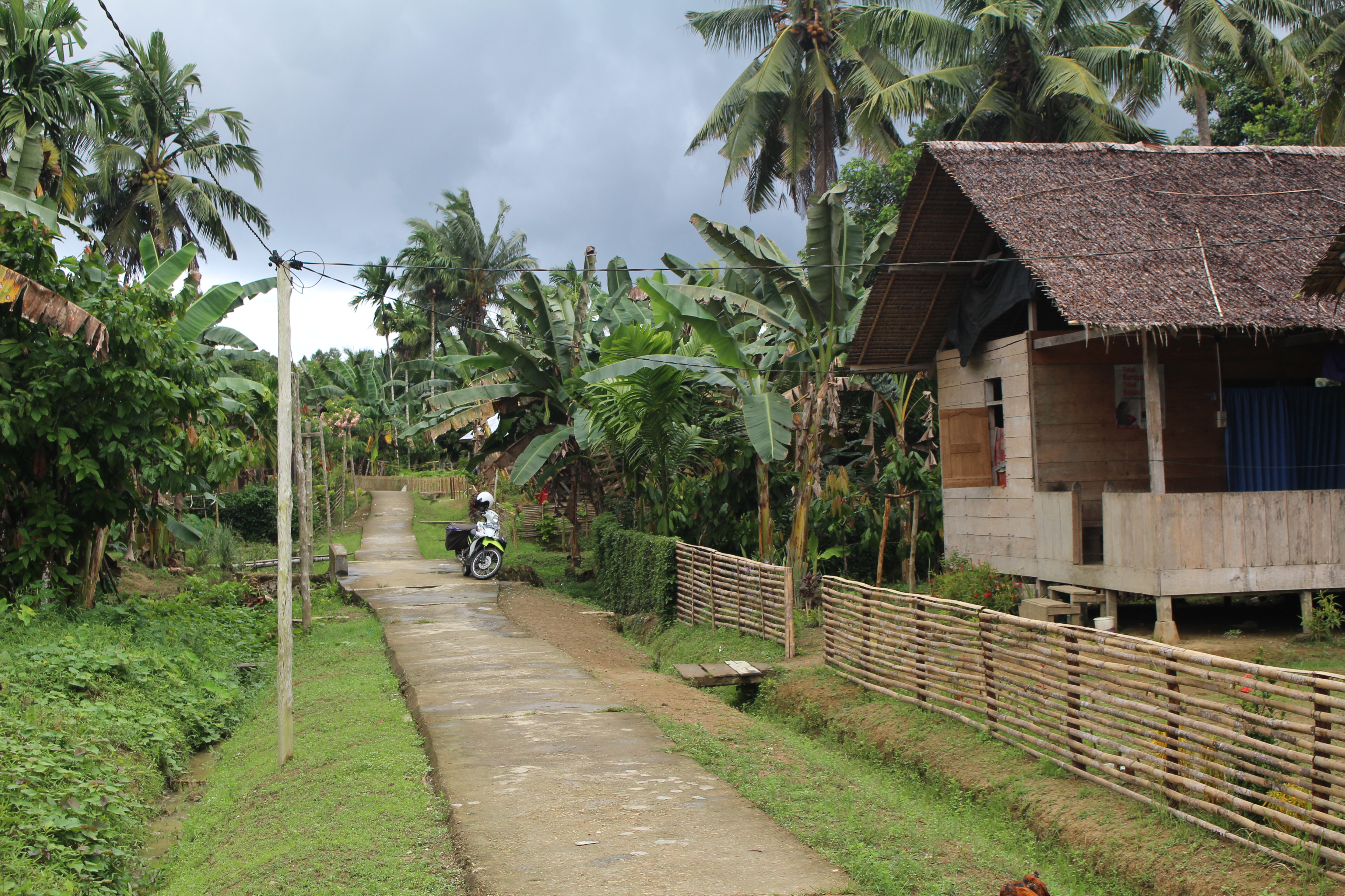
There was a concrete walkway stretching to the left and the right, and it wasn’t clear which way to go. A young girl and two younger boys were approaching from the left, so I gave her a questioning look and pointed each way. She pointed right, so we went that way, while they stopped to inspect our dinghy.
The concrete walkway turned out to be Main Street, houses all along each side, almost every house having people staring at us. But everyone waved back at us, and many smiled hello. We crossed a couple side streets, constructed the same as Main Street, and we crossed a covered bridge over the river. We spoke with two or three men that we passed, but not enough English to communicate. We passed a “gathering place” that had a tavern-like aspect, mostly men hanging out. Places like that make me nervous — how the group will receive outsiders. But again everyone seemed friendly, and we waved and smiled and said hello, and continued on by.
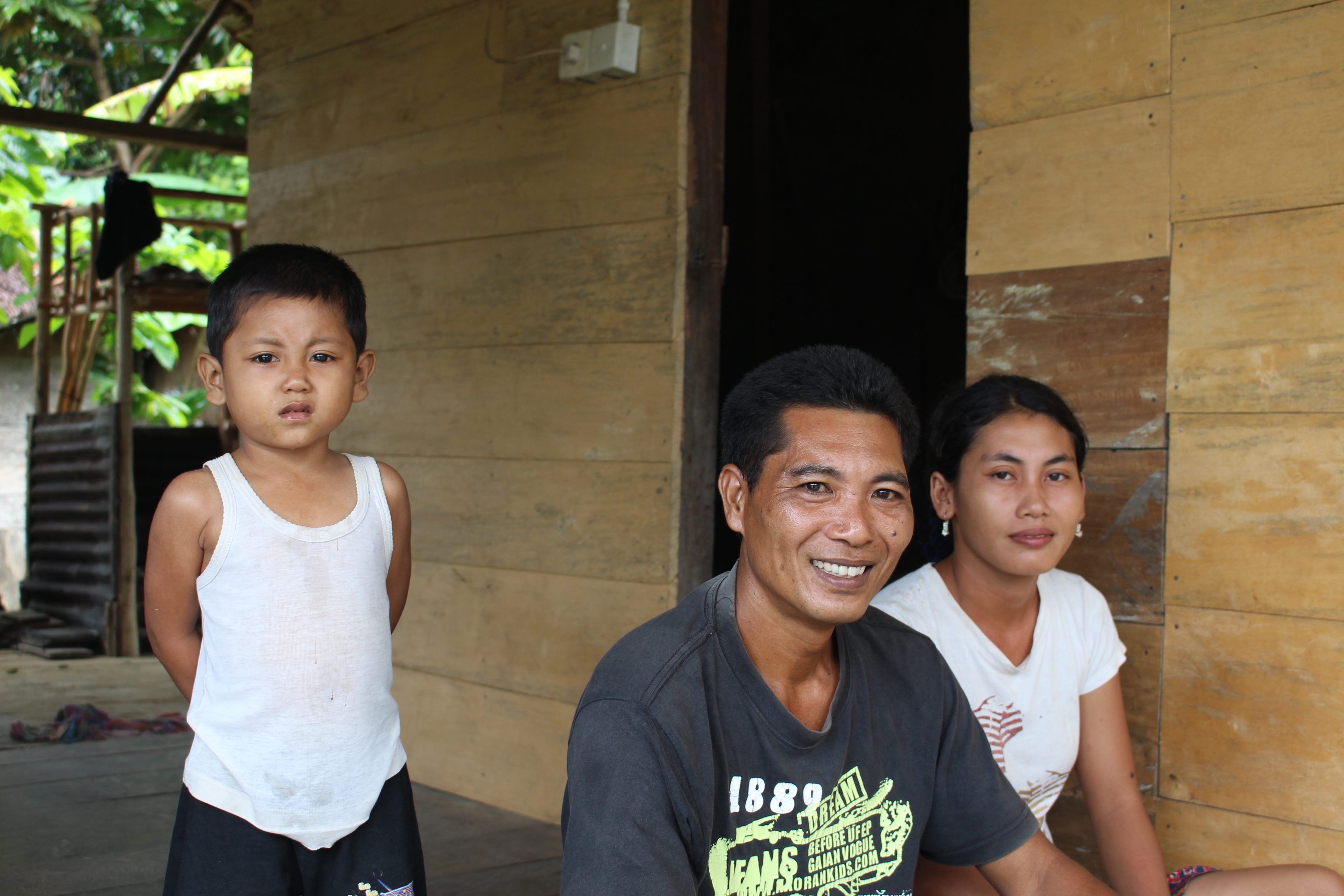
And then we saw a man planing a board for his house, and he stopped and said hello in pretty good English, and invited us to join him. We sat on his deck and had water and sweet tea, and met his wife and son and brother and a neighbor. Communication was very limited, but as a new batch of rain poured down we tried to learn some words from him — cat, dog, house, roof (beautiful and watertight thatch), duck, wife, son, etc. Mostly he was teaching us the Indonesian words, which we had at least a tiny chance of remembering, but sometimes he would teach us the Mentawai word. All I can remember of Mentawai is thank you, and even that I’m sure I now have wrong, something like matsurai bagata…
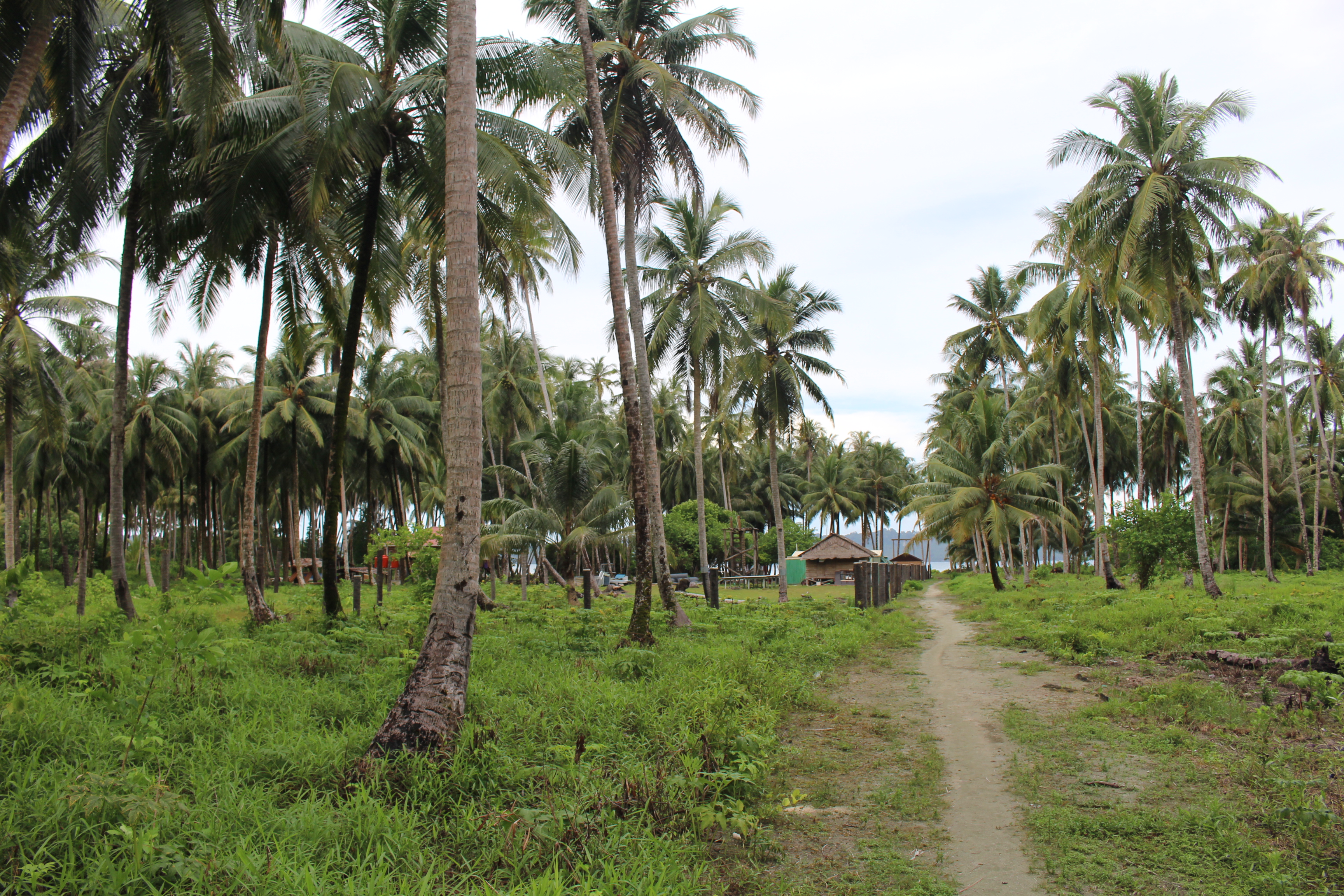
We had read that the Mentawai were “semi-nomadic” but that much seems to have changed, as they have well built houses and other signs of permanence. They grow bananas and coconut and cacao and some things we couldn’t identify. We saw some people carrying big bags of copra out of the jungle, probably bound for the ferry as a cash crop. Lots of chickens roaming around. Wires for electricity, but the only satellite dish we saw was at the “tavern.” Kids had book bags, and were clearly coming home from school in the rain. There were a couple motorbikes (even though no road, per se), a couple bicycles, someone had earbuds listening to music. But the signs of modernity were very limited. Funny how it seems that those with the least are the happiest and friendliest…
The rain eased as the tea was finished, and we thanked them profusely and headed back the way we had come, feeling much more at ease now.
Returning to the bay, we decided to run by the port to check it out. There was some activity there, loading bananas and other cargo on to the ferry, and interest in us. We decided to check it out, and went ashore. An English-speaker (sort of) named Timo adopted us, obviously hoping to be our guide for a fee. There was a little restaurant, so we went there and bought him lunch. While waiting for our food a policeman showed up, nice guy, no problem, but wanted photocopies of our passports. That was going to require a trip to the boat (and probably some money). So we bought him coffee since he had to wait for us to eat, and then Timo and Mr Polisi and another guy of unknown connection hopped in the dinghy with us, and off we went. We let them look around on the boat, and we chatted, and then we said it was time to go.
Timo took me aside and said I should give him 300,000 Rupiah to give to the police guy, for our safety. I said that was too much, and offered 50,000. Or I said I had $5 US, which some harbormasters seem to prefer. He declined the $5 but said I should give him 100,000. I was not in a strong bargaining position, because the only bills I had were 100,000 — I didn’t have a 50,000 note. So I gave him 100,000 (about $8). Tim took them ashore, and he told me after that the policeman declined the money. So Timo gave it to the other guy — still don’t know his role. Whatever; not a big deal except that we are almost out of Rupiah. Getting desperate for an ATM!
Waiting for the sun to sink below the clouds and cool things down, suddenly there is Maggie coming to anchor next to us! Tim and I swim over, just to cool off, and invite them over for a sundowner. They had never been aboard our boat! We pulled out the last of our snacks, and swapped stories about the places we’ve been, and what lies ahead. Very nice. Another memorable day.
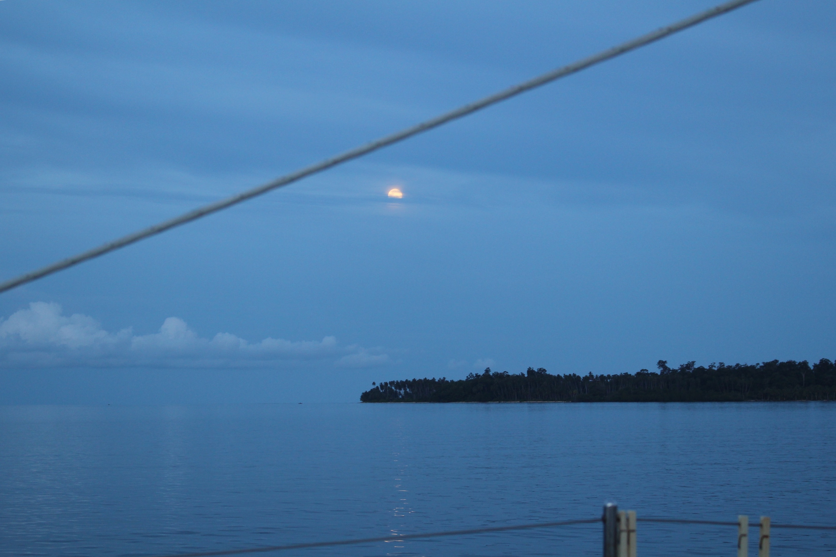
Heading down the west coast of Nias from Lahewa, our first stop was Afulu. The entrance was exciting — appearing to have breaking waves all across it. Our cruising guide, limited though it is, gave waypoints for a passage in. Nerve wracking, but no problem. Once inside, there is a huge peaceful bay, where another yacht was anchored. We had a chat with Tim, on Revel, but for the most part we just enjoyed the peace and quiet.
We started early the next morning, heading out through the gap in the surf just as a squall was coming overhead. The squall provided welcome shade, and for a couple hours provided a decent sailing breeze. But as the breeze died out midday, we decided to stop at the Hinako island group. We spent an hour motoring around looking for a decent anchorage, and never really found one. Maybe that’s why these islands aren’t mentioned in our guide or in the notes from any other cruisers!
Very remote place! And made rather eerie by surf breaking in what appears to be open water, no land in the vicinity. The chart shows shallows at some of those places, but others it shows being deep, which is disconcerting.
In the morning we tuned in to an informal cruisers “net” on the radio, and learned that another boat, Convivia, was also bound for Lagundri (south end of Nias), and they were out of fuel. We offered to meet them outside the anchorage and pass them a jerry jug of diesel. As it turned out, they filtered a gallon or so from the dregs in their own jugs, and then sailed in without assistance. But they invited us over for margaritas!
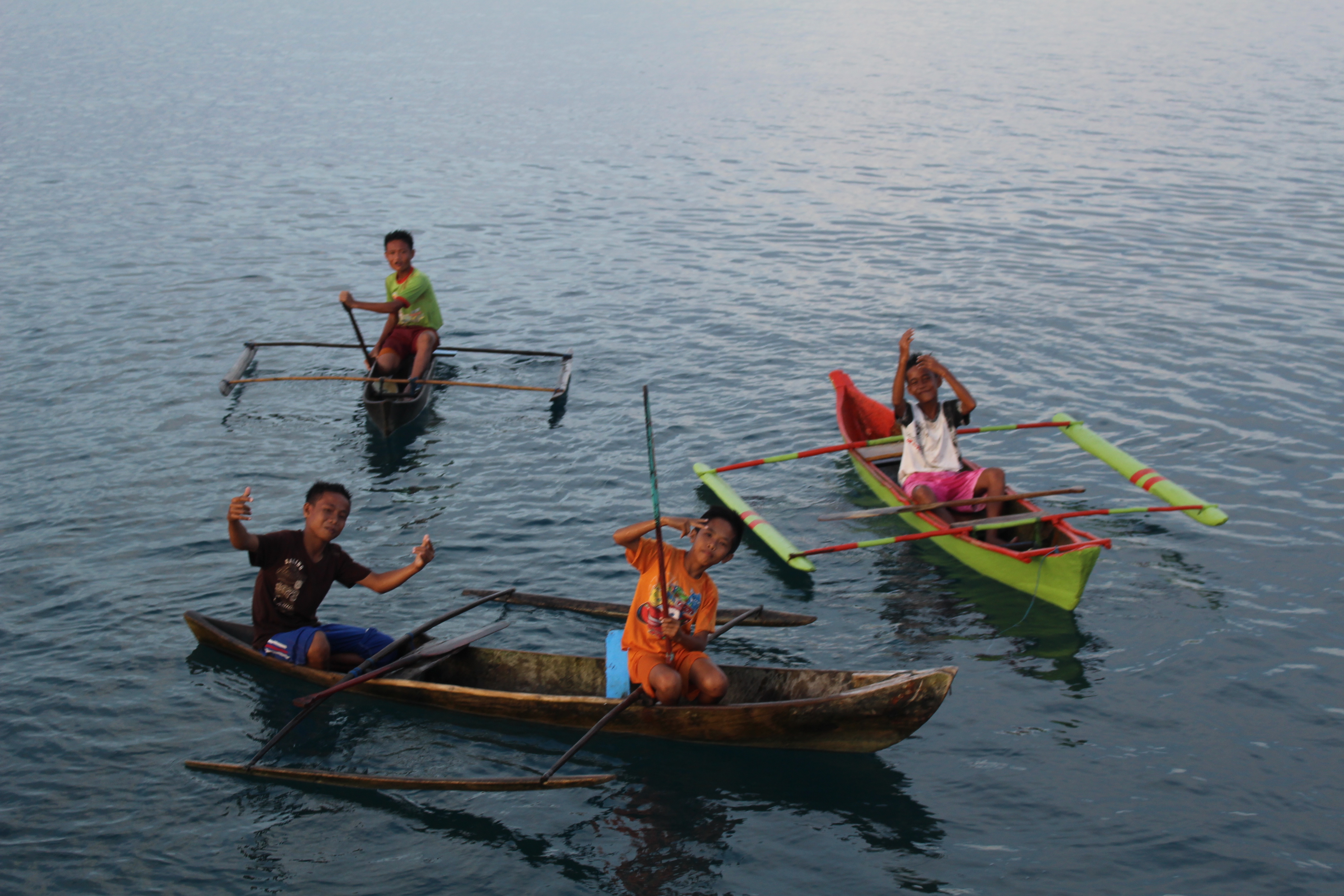
They are a young couple with two kids, maybe 11 and 8. The kids could not be more different from the kids on Tahawus — they are outgoing and want to interact with the adult visitors, and serve us food and drinks, and tell us their ideas about cool inventions. Tomorrow we all go into town together with Todi.
Todi paddled out to us on his surfboard. He speaks pretty good English (though he has the Indonesian habit of saying Yes whenever he doesn’t understand what we say). We had a long talk with him, including arranging tomorrow’s tour and ride into town, for us and for the four Convivians. Then in the evening he took us to his family’s losman (guesthouse) for dinner. We didn’t realize we would be the only ones there. Nor that ordering chicken with our curry noodles meant that they would have to buy/kill/prepare a chicken, and it would take over an hour! No worries, we got to meet Todi’s mother, father, and wife, plus they had Bintang beer that we haven’t had for months. Cold and delicious.
We also didn’t realize when we followed Todi’s lead to shore that we would be tying the dinghy just off the jagged coral, stepping off to the coral, and walking over 50+ yards of coral and mud to get to solid ground. Tim had a case of the shore-sways, perhaps augmented by the margarita, and he went half way into the drink. I blew out my flip-flop, as the appropriate song goes. After the fine meal and large-size Bintangs, we got to find our way back through the mud and over the coral in the dark. We found the dinghy okay, except that the line tying it to the shore had untied itself, and it was hanging by its stern line 50 feet out in deep water. Whatever, a little swim after a big meal…quite nice. A good time we had, and wondering what adventures are in store tomorrow…
@@@@@@@@
In the morning Todi had a truck and driver lined up. We picked up the Convivians and rode through small surf to the beach. Locals helped us pull the dinghy above the high tide line. Off we went to town — first stop a gas station to buy about 80 gallons of diesel (10 for us, 70 for Convivia). This was a little dicey, because it is not legal for us to buy diesel — the government subsidizes the price, and thus it is only for Indonesians. Foreigners have to buy at designated places at higher prices, but of course there is no such place nearby, and of course locals want to pass along the low price to us with a small markup.
We tried to get a firm price before filling the jugs, and our guide said we could have the pump price (since he was already getting lots of money from us for the truck and driver). But then the gas station wanted extra. Tucker from Convivia held the line, giving them a very small bonus, but basically saying no to their requests. Meanwhile our driver was watching police vehicles fueling, and he looked very worried. We did the deal, no problems.
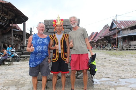
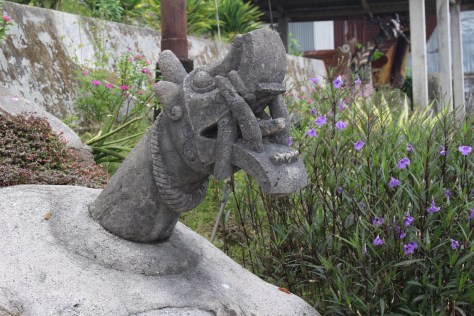
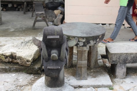
Then to lunch; then to the supermarket for a few things; then to “The Village.” We had no idea what to expect there, but Todi said we could see the traditional stone jumping. This is where a boy coming of age has to jump over a two meter high stone wall, some say with sharp sticks on the top, some say with no knowledge of what’s on the other side (maybe that’s metaphorical), and we also heard it said that a man couldn’t marry until he successfully jumps (but others laughed at that).
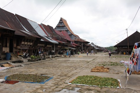
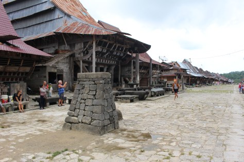
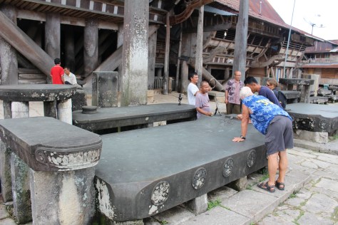
The Village turns out to be atop a mountain. Or at least a very long steep hill, and far from the water. From the road you walk up 50 or so stone steps, to a remarkable place. It is expansive and very flat, as though the top of the hill was sheared off or ground down. There is a wide straight paved-with-stones “Main Street” stretching out ahead, with houses and shops strung all together along it. Half way down there is the King’s house on the left, and another long wide flat street across from the King’s place. I am amazed by the stone paving, and how wide the streets are and how flat. This was clearly a special place, a place of power! And so far from the sea!
By now we are being attacked by men selling traditional (maybe) carvings and necklaces and other souvenirs. They are unrelenting, following us everywhere, asking us to look again at their wares — it is for their children to be able to go to school. I buy a carving and a necklace. In retrospect I might have bought several necklaces, but I feel like once I’ve made a purchase I have to say no, no, no, in order to fend off the others and be able to breathe.
Having heard so much about the jumping, it seemed obligatory to pay to see a young man jump. It seemed better in the stories than in practice, but I imagine in the days of old (Todi’s grandfather jumped, so only two generations back) it must have been a major event with everyone watching and feasts and parties.
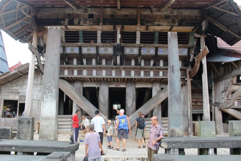
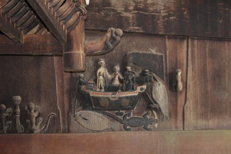
We walked through the King’s house, which also served as a community house, hosting feasts. It is built up on colossal tree trunks; it is huge; it is massive; and like the streets it has a very solid, very flat (but in this case wooden) floor. The whole Village seems like a museum, but the houses (except the King’s) are lived in. And not much interpretation/history is provided. It was one of the most impressive sights I have seen on this voyage, and I didn’t even know it existed. Glad Todi set this tour in motion.
Then back to the beach. Except…we were supposed to stop at a vegetable market and a store for buying more mobile data. Things got messy at this point. We were already over the 4 hours we had hired the truck for. We needed to get all the fuel out to the boats, and then return some borrowed Jerry jugs. And we still wanted to complete our errands. Tucker and I did fuel; Tim and Victoria had a shopping adventure that included other errands that the driver had to do, plus a flat tire! It was exhausting and more expensive than planned, but it got done. And I got to hang with Tucker for a while and talk about Maine (he’s from Damariscotta), and what made us good at our jobs, and my men’s team, and community, and cohousing, and his dream of having a farm where people doing cool things can come to live cheaply in community, and share their work and have interesting synergies happen. Memorable day!
@@@@@@@
Next day we were thinking of renting surfboards for a first-ever try at surfing. But first there was the leaky hatch to repair. And more research into a possible battery replacement configuration. And I wanted to replace the fuel filters on the starboard side, because that engine seemed to labor at times. That turned into a long hot messy process, as did trying to bleed the fuel system after, and get the engine to start.
Then Todi came by for a visit, paddling his surfboard with one hand because he had my sandals in the other. He had seen my “blow outs,” and had offered to get them fixed for less than $2. He delivered them back repaired. Not tested yet, but he asserts they are “very strong.” And then I wanted to clean some of the “beard” off our waterline, and say goodbye to our new friends on Convivia. Oh, and go aloft to check that lines aren’t chaffing at the masthead.
So…we didn’t get surfing. That’s a little sad, since we are at a primo surf site — people travel from all over the world to surf here. But on the other hand, we’re not going to get our first lesson out on the big reef break, but on the tiny beach break, which is not what surfers come here for! In any case there may be more opportunities just ahead…